Networked Urbanism
design thinking initiatives for a better urban life
apps awareness bahrain bike climate culture Death design digital donations economy education energy extreme Extreme climate funerals georeference GSD Harvard interaction Krystelle mapping market middle east mobility Network networkedurbanism nurra nurraempathy placemaking Public public space resources Responsivedesign social social market Space time time management ucjc visitor void waste water Ziyi

social
Focusing on the relationships between people in a given context. Our role as designers being to connect our design and strategies with people’s needs and initiatives, to assist the creation of communities and to enable systems and spaces for interaction, social creativity, and the emergence of behaviors.
Here we are. We started working on the void concept and his different variations, visible in the video at the following link:
http://networkedurbanism.com/posts/nurra-empathy/
After this first step, we tried to understand better the Nurra territory, searching for these voids there and knowing that it was possible to find in this big part of north-western Sardinia a strong potential energy, ready to be released. It was very important talking with people in this complex and difficult villages, where the first impression is a state of abandon and resignation of public spaces, contrasting with well-finished and dignified private houses and people, in particular in Tottubella.
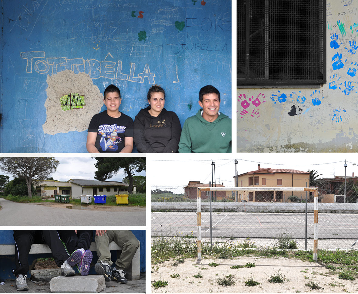
So we started figuring out that there were material voids, and we are talking about public buildings and agriculture fields, but also immaterial voids, like social voids. The good new is that people there still has the ability to think about his future and, in particular, a future in that places; not in every Nurra village but in some cases we found people intrested in improving his knowledge and trying to make things better, especially about the place where they live. We talk about people between 15 and 45 years old, and in particular young boys and girls.
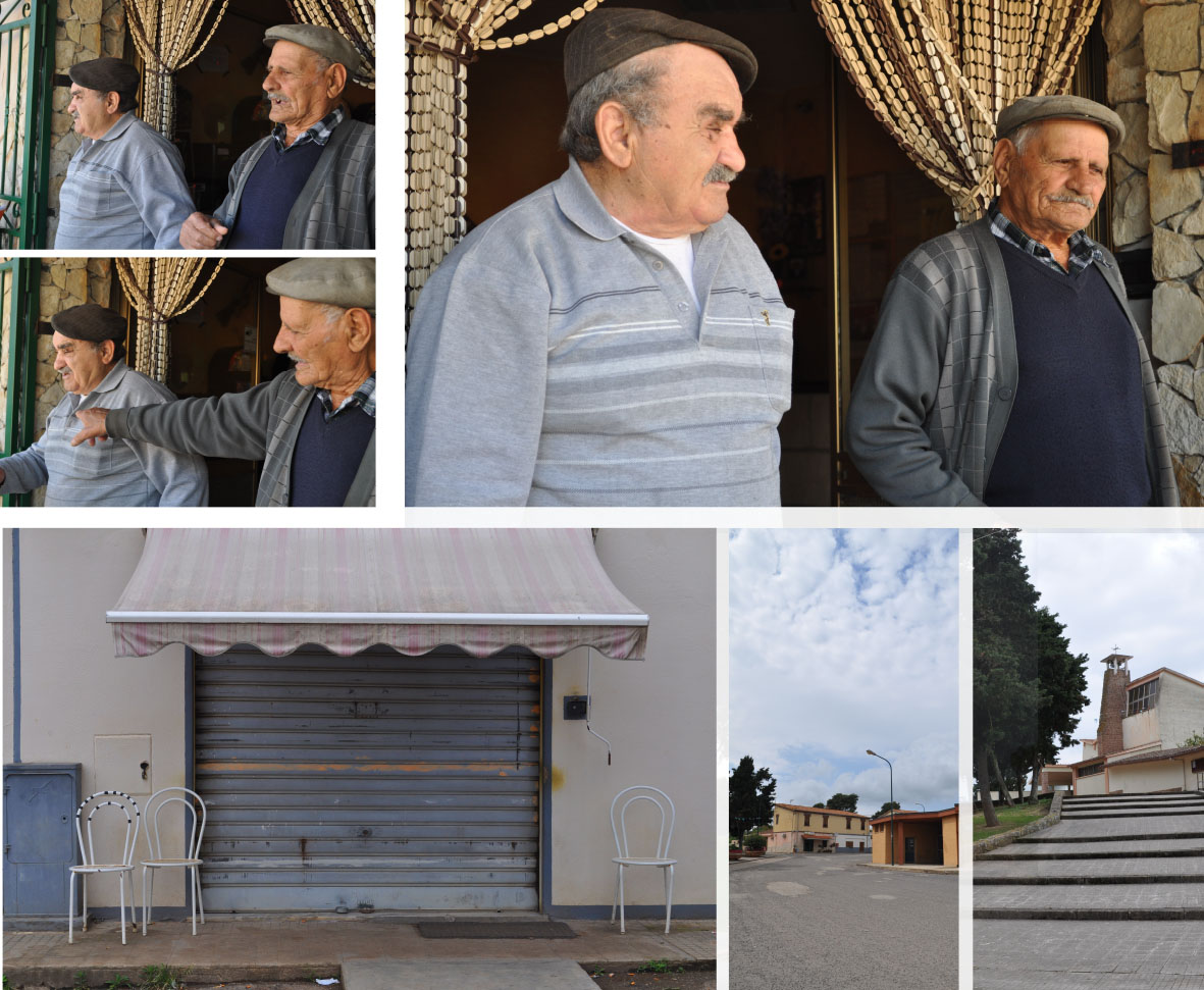
We think it’s also important talking with elderly people, ’cause they’re a big part of the community in these villages but, instead of the bar, they have no place to go (like teenagers and children). What’s intresting is that they keep the memory of the villages because they were there when Tottubella, Palmadula and so on were founded.
Our next step is finding places where re-activate communities, creating a double grid: one internal to the most important villages, one in which villages are grid nodes themselves, starting from that voids we were searching for.
Title by Agriru Canu (Salvator Ruiju), 1957
A darsi da fare sia!
Here we show our next step: the questionnaire.
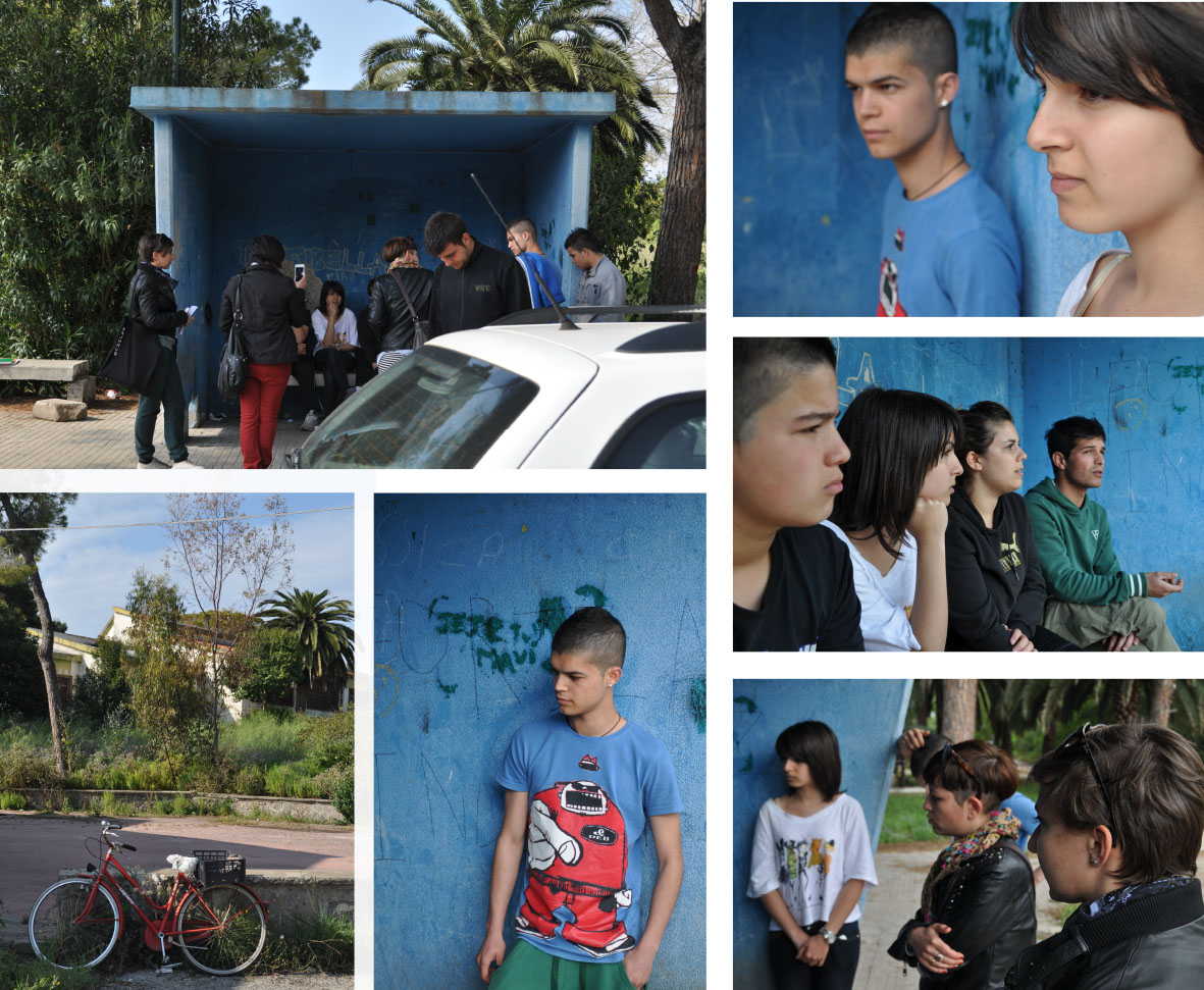
The last days we drive across the little villages of the Nurra to meet some people because we would like to know something about their lives and their problems.

We went to Tottubella, Santa Maria la Palma, La Corte, Palmadula, Argentiera and Pozzo San Nicola. In this way we had a little view about the different situations; we prepare an anonymous questionnaire in order to find some data about people who lives there, what kind of resources and needs have the site, which are the skills of each person and to start a relationship, and we made a video interview of some young guys of Tottubella.
Waiting for the results of the questionnaires and for the relative data we are preparing some diagrammatic maps about the different little villages.

We meet people of different ages and reading the answers we decided to concentrate our attentions to a range between 15 and 30 years old.
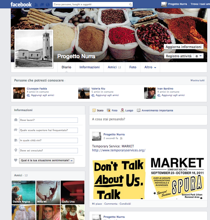
In the same time we create a network with the people of the different villages we met by a facebook page called Progetto Nurra where we can share information and suggestion involving young people in this project. Now it’s just the first statement but we are working with them for creating a brand and update the page.
During all this research we turn our starting idea on a different direction and we start to think with the eyes of people that lives there and we realized that the last proposal was made by an external view before getting in touch with the local peolpe. Thus we started to investigate about a flexible street market that can change its location during the week and its function during the day. Whit this system we can create a market of local products.
We are still working on each these aspects, we are trying to involve even more people.
So… stay tuned!!!
Here the first video about Economy topic for our Studio about Networked Urbanism in Nurra.
Concept for this first step has been the free-exchange of goods, services and knowledges between individuals. We are still investigating if that concept is something that actually really fits on our site. Thus we started from the Economic and Resource topic trying to focus on a social aim as well, in order to revitalize the whole area by its own origin: the agriculture and its goods.
Next step will be investigating more by chatting with local people and asking them to answer some questionnaires.
Stay tuned!!
Bostonians, through their water usage, are one part of an extensive, connected system. The delivery of water to and from your home comprises of more resources than water alone and results in large scale infrastructural interventions that shape our landscape and impacts ecosystems on both sides of the chain. Through exploring methods of communicating these concepts, I hope provide a tool that educates users as to what resources go into the treatment and transport of water, how they’re using water in their homes and why it’s important to conserve it.

“Know Your Water” came out of an interest in the hidden infrastructure of the city. Cities have complicated networks of resources that lie beneath them and only through the occasional clue, such as a manhole cover, are we even aware of their existence. Water, electricity and gas all appear at the click of a switch as if by magic; their supporting infrastructure only questioned when there are problems. I was particularly interested in the water network of Boston due to the sheer size of its supporting infrastructure. Reservoirs and aqueducts are incredibly large interventions and Boston has one of the largest man made reservoirs in the world. How have these massive landscape interventions been so successfully removed from our consciousness?
The first half of the semester was devoted to demystifying the water network, understanding all of the pieces of the potable water system from collection to use with the ultimate goal of targeting issues within the system that need to be communicated to the public. Since people tend to be very proactive about pushing for improvements in visible infrastructure such as streets, I hoped that I could help encourage them to take an equal interest in their water infrastructure and push for improvements in the aging underground networks.
Through research and interviews I realized that most of the issues in the Boston area lie not within the potable water networks, but post-use in the sewers. For example, combined sewer/storm water overflow pipes are driving the design of our sewer systems and waste water treatment plants, causing major inefficiencies in the system except during large storm events. Additionally, due to old pipes, clean water is infiltrating into the sewers which, combined with a largely impervious surface, are lowering the ground water level causing historic wood pilings in buildings. However, the most essential piece of information I found was that the knowledge gap between the user and the water system is at a very basic level. Partially due to the abundance of rain in the region, clean water is majorly undervalued and many users don’t understand why they should conserve it or even pay for it.
Currently, the average person pays only 1 to 2 cents per gallon for tap water in the Boston metropolitan area. Considering that as our population grows water is only going to get scarcer and prices cannot remain so deeply subsidized indefinitely, the goal of the project shifted to address the education of the average user towards the larger infrastructural, resource and ecological requirements of water usage.
The infrastructural requirements to provide water to the entire Boston metropolitan area are obviously quite extensive. There are three water sources feeding the system: the Quabbin Reservoir, the Wachusett Reservoir, and the Ware River. Much of the land that drains into these sources, especially the Wachusett and Quabbin, is protected and came at the cost of displacement of multiple towns. Additionally, the water travels at least 80 miles from collection to ocean release in pipes that range from 4 inches 23 feet in diameter.
There are also many other resources required in this process. A huge amount of energy is necessary to pump and treat waste water and despite many efforts to use renewable resources as often as possible by the Massachusetts Water Resources Aurthority, 84% of the energy they use is still coming from power plants. There are also several chemicals that go into the water treatment process, disinfecting and altering the water composition.
Perhaps most importantly, the understanding that our water usage is part of a larger, connected system is crucial. Our use affects ecosystems on both sides of the chain, and if the awareness of where our water will go can be achieved, then perhaps we can start to make smarter choices about our usage and what we put down the drain.
“Know Your Water” is not just about the water system alone, but is also an exercise in effectively conveying information. Much of my research is available through various water authorities’ websites but is not presented in an easily accessible format. The process of water usage is complicated and systemic; the typical diagram is not effective at communicating these types of overlapping processes. Through a reiterative method, I used animation as a tool for experimentation in communication. The resulting short animation is hopefully not just explaining the process to users, but by presenting the information in a neutral way, is asking people to have an opinion about it. Working with the water resource authorities to make this film most effective, it would ideally be provided to users at the point of payment online. This animation is only the basic information, leaving many opportunities for the more specific sewer issues to be addressed in accompanying videos.
Today’s highly connected world has enabled new forms of communication that have heretofore been impossible. Platforms such as Facebook, Twitter, and Quora allow us to connect with our friends, followers, or people of shared interest, essentially without regard for their physical location. These new forms of interaction are invaluable in their ability to target a very specific audience in ways that are difficult or impossible without current technologies. But while these technologies have largely erased spatial barriers, its potential for facilitating proximal interactions has been left largely unexplored.
What if there was a platform where we could easily share photos and have discussions with fellow event-goers with whom we share our current location? What if this platform could let us talk to our neighbors about community news, ask about a lost pet, or put an item up for sale? What if this platform could allow a new tenant to ask existing residents about move-in advice?
Despite the tremendous value in locally-targeted communication, there is as yet no dominant platform through which to do so. Services that connect you with your residential neighborhood do not allow you to engage with people outside of its boundaries. Services that let people to post in predefined public places do not reflect the users’ sense of place. Services that allow people to post geolocated messages via their physical location do not capitalize on the inherent advantages of the digital medium to transcend spatial restrictions.
For these reasons we decided to develop our own solution:
![]()
Hear Here is a location-based discussion board that allows people to connect with each other through the commonality of place. It allows users to engage in threaded discussions that are linked to locations around them. Nearby discussion threads are displayed based on the user’s physical location. Users can also view discussions in other places by moving their virtual selves to that location. These discussions are persistent—they can be viewed and continued by future users even after the original participants have left. Hear Here is designed to foster both local community and provide an avenue for transient populations to engage with locals and with each other.
Hear Here is entirely user generated. Its users create both the content and the geometry of the places to which these topics are tagged. These places can range in scale from a single building up to a city district. A place can be as well-defined as a building or as nebulous and transient such as an impromptu street festival. And because these places not defined by top-down categorizations, Hear Here can provide insights into how people truly conceive of place.
Hear Here can be understood as a conciliation of the digital layer with the physical world. Discussions, conversations, and thoughts are mapped to a virtual representation of real space. Hear Here is still cyberspace—you are free to move your virtual location wherever you want—but it straddles the digital/physical divide in a way that marries the qualities of both kinds of space. It liberates real world users from physical restrictions by allowing them to engage with others at any place and any time, yet it still retains the real world spatiality that is valuable for targeting users. This spatial duality is still a novel and under-explored conception, but we are excited to see how people utilize it in ways we cannot yet imagine.
Introduction
With the fiscal challenges and complicated regulatory processes that characterize many American cities today, communities often struggle to fully utilize the potential of public spaces to stimulate social and economic activity. This project focused on developing new strategies for activating urban public spaces by applying the existing talents and resources in the city to create temporary interventions that foster community and activity. Several interventions were part of the experiment, ending with an ephemeral intervention that mobilized the existing resources and talents to transform a space that is often underused and closed to the public into a public space for the wider Cambridge community.
Background
Many American cities today are grappling with the role, control, funding, and use of public spaces in their urban communities. Frequently, American cities face immense fiscal difficulties as municipal budgets are stretched thinly to cover the large expenses of many departments, services, and programs. Given the many demands in the municipal operating and capital budgets, it can be difficult for cities to prioritize maintaining and programming public spaces. As a result, communities may not derive the social, economic, and health benefits that activated and well-used public spaces can provide for urban societies. The servicing and programming of public spaces could be provided by non-governmental organizations and individuals, but public spaces are often operated under tight regulations and bureaucratic processes that can make it challenging for non-governmental organizations, programs, and services to use the public space for the benefit of the community. Unfortunately, these funding and regulatory issues create a challenging situation for American cities: urban communities may not be maximizing the returns of the important services and benefits that well-used, active public spaces can provide for individuals, neighborhoods, businesses, and government entities.
Process
As a student in the Master in Urban Planning program at the Graduate School of Design, Melissa Jones has been studying these issues surrounding public space in American cities today and she focused her studio work in “Networked Urbanism” on this topic. Recognizing that the complexity of these problems, Melissa’s work this semester focused on a series of experiments to test out strategies for activating public spaces. Her efforts aimed to create ephemeral interventions that activated urban spaces in novel ways and fostered interactions between community members.
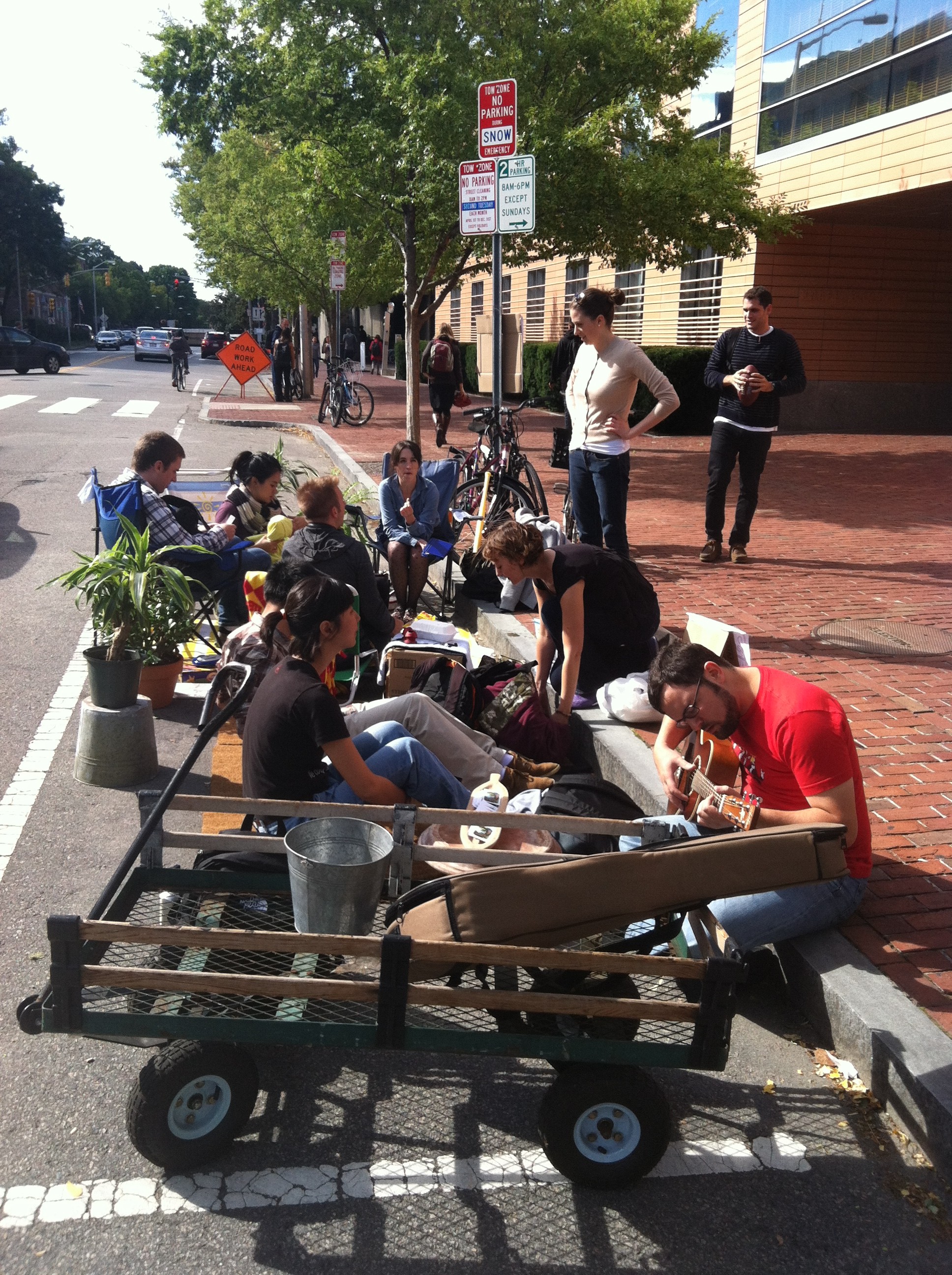 Park(ing) Day
Melissa’s first intervention was for Park(ing) Day in Cambridge on September 21, 2012. Park(ing) Day is an international event that was started in San Francisco by Rebar, an urban design and activism group, to challenge the conventional uses of urban street space. Street parking spaces normally occupied by parked cars are converted into small parks for one day. Melissa worked with the City of Cambridge to get the necessary permits and the Harvard Urban Planning Organization to create the Graduate School of Design’s park. It was located on Cambridge Street near the GSD, and local businesses loaned plants and matted flooring materials to make the parking space into a softer and more inviting place for people. The free ice cream offered to passersby helped draw them into the park. Students, residents, and employees from the area stopped by to hang out in the park, and Park(ing) Day succeeded in activating a public space in a new way and encouraging community interaction in the public realm.
Melissa’s second project focused on new strategies for activating the Cambridge Common for families. When she took her plans to the City, however, she learned that receiving the necessary permits and approvals for temporary interventions and events in Cambridge public spaces can take up to six months. Rather than focus on an intervention several months out, Melissa decided to set aside the plans for the second project and focus on a different intervention that could be completed within the semester. Switching strategies, she approached the Harvard Common Spaces Program, which aims to activate public space on campus to foster community interactions. Melissa talked with Program staff, and learned that they had great success by anchoring ephemeral interventions to more capital-intensive, physical interventions, like seating, tables, fire pits, and an ice rink. However, as they did not have strong anchor programs in place during November through January because of weather challenges, another approach would be necessary. Nonetheless, it was very inspiring to find a formal university program that worked to address the issue of public space activation and fostering community on campus, which would serve as a template for Melissa’s own interventions.
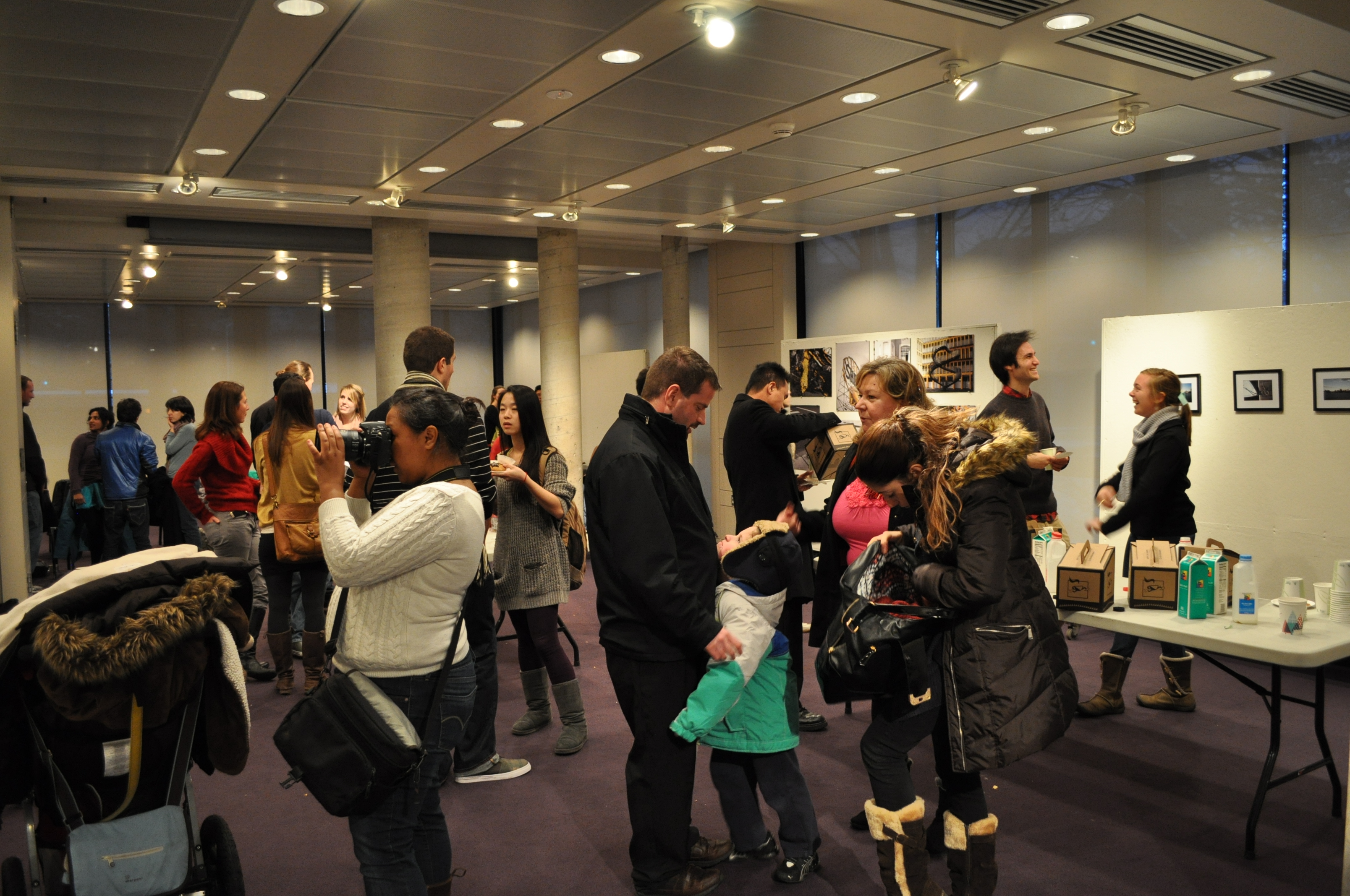
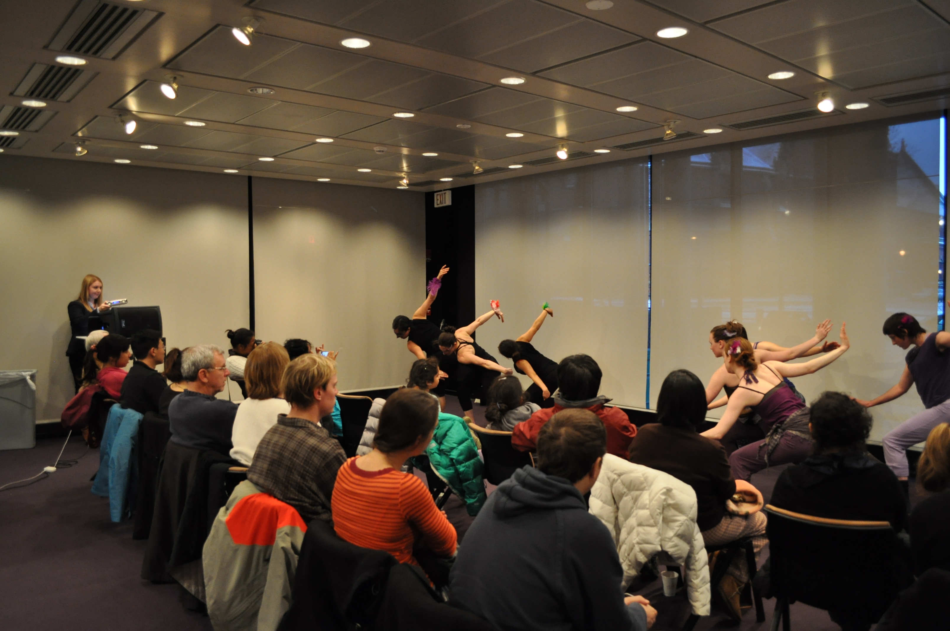
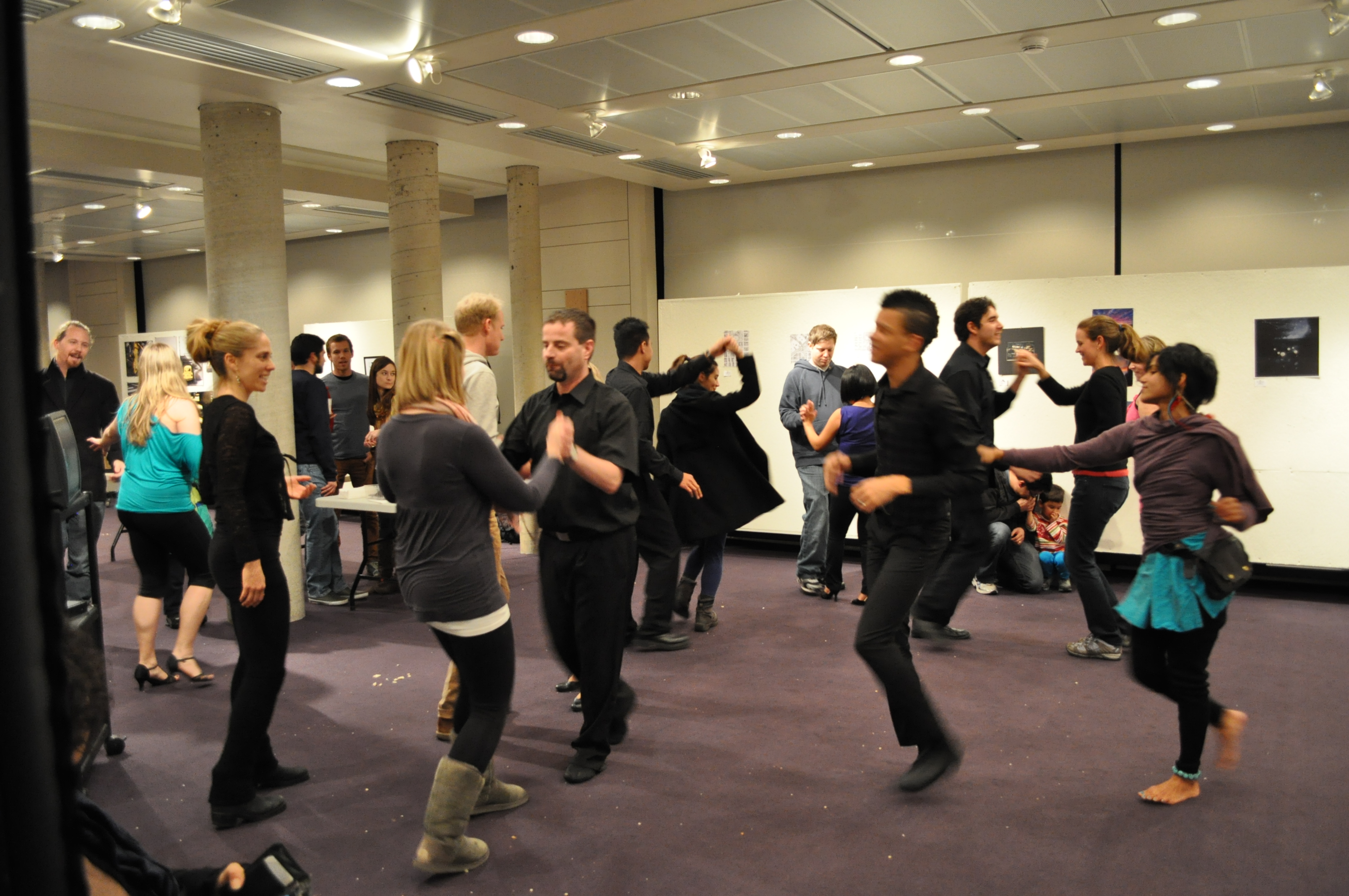
In strategizing with Loeb Fellow and Lowell Cultural Planner LZ Nunn, Melissa developed a plan for a last intervention: to mobilize the existing resources and talents in the Cambridge and Harvard arts communities and encourage more interaction between Harvard students and Cambridge residents. The ephemeral intervention would take place on Harvard campus to activate an underused space and turn it into an active public space for an afternoon. She reached out to many community arts groups across Cambridge and Harvard and received enthusiastic responses from many dance performance groups who liked the idea of bringing diverse communities together in a new space through the arts. Melissa also received many positive responses from local visual artists who were interested in contributing works to an art gallery. Mobilizing the visual artists and dance performers to come together in a new space for an afternoon resulted in Decemberfest, an ephemeral intervention to activate the frequently closed GSD porticos with public community interactions. Sponsored by the Harvard Urban Planning Organization and supported by the Urban Planning and Design department, Decemberfest was a great success. It brought together sixty to seventy people from diverse communities, including MIT, Harvard GSD, Harvard Kennedy School, and the wider Cambridge community, breaking down the divide between the student and resident populations for the afternoon. The salsa lesson at Decemberfest was particularly successful in encouraging the direct interaction of the diverse individuals. The project succeeded in transforming an underused, private space into a public space for the afternoon through the arts and resulted in wider community interactions that the intervention had aimed to promote.
Conclusion
Ultimately, through “Networked Urbanism,” Melissa experimented with different strategies for activating urban spaces in Cambridge. Despite the regulatory roadblocks and bureaucratic difficulties that she ran into, two of the experimental interventions proved successful in changing the way urban spaces were used, challenging the conventional and traditional uses and roles those spaces played in society. The projects brought together diverse individuals from communities across Harvard and Cambridge, promoting more interactions between the student and resident population and addressing the social aspects of the “town and gown” issue in this area of the city. She had great success with coordinating and mobilizing a community’s existing resources and talents towards activating public spaces and providing new uses of urban spaces. These projects can serve as a blueprint to be employed by cities to capitalize on their existing resources and networks to ensure that public spaces are utilized to their full potential, increasing the vitality of the wider community.
« Previous 1 … 3 4 5 6 7 … 10 Next »