Networked Urbanism
design thinking initiatives for a better urban life
apps awareness bahrain bike climate culture Death design digital donations economy education energy extreme Extreme climate funerals georeference GSD Harvard interaction Krystelle mapping market middle east mobility Network networkedurbanism nurra nurraempathy placemaking Public public space resources Responsivedesign social social market Space time time management ucjc visitor void waste water Ziyi
placemaking
Taking action in public space, involving the people that use it and care for it. Through usually lightweight, low-cost, yet high-impact structures, workshops and collective performances that help creating a local sense of community, revitalizing the city and raising awareness.
MYPS is personalized cloud to ground cartography that reshapes both how we compose our farewells and how we receive the farewells of others.
A P.S. is an afterthought – an easily appended message that crosses our mind after we think we have said all we mean to say. Yet the postscript also contains our final words, which are actually quite powerful. When combined with the power of place in the development of memories, these afterthoughts can create meaningful journeys for our loved ones to revisit after we are gone.
MYPS uses the GPS capabilities of mobile devices in combination with familiar media sharing formats to facilitate the process of recording our shared memories so our loved ones may literally revisit them after our passing.
The following video is a preview of my final review “experience”. It shows how MYPS could tie together three generations of memories. When my Mom came to see me in Boston, we visited the places my grandpa remembered from his own time living here during World War II. After her passing, I will be able to revisit our route to see the memories she left behind.
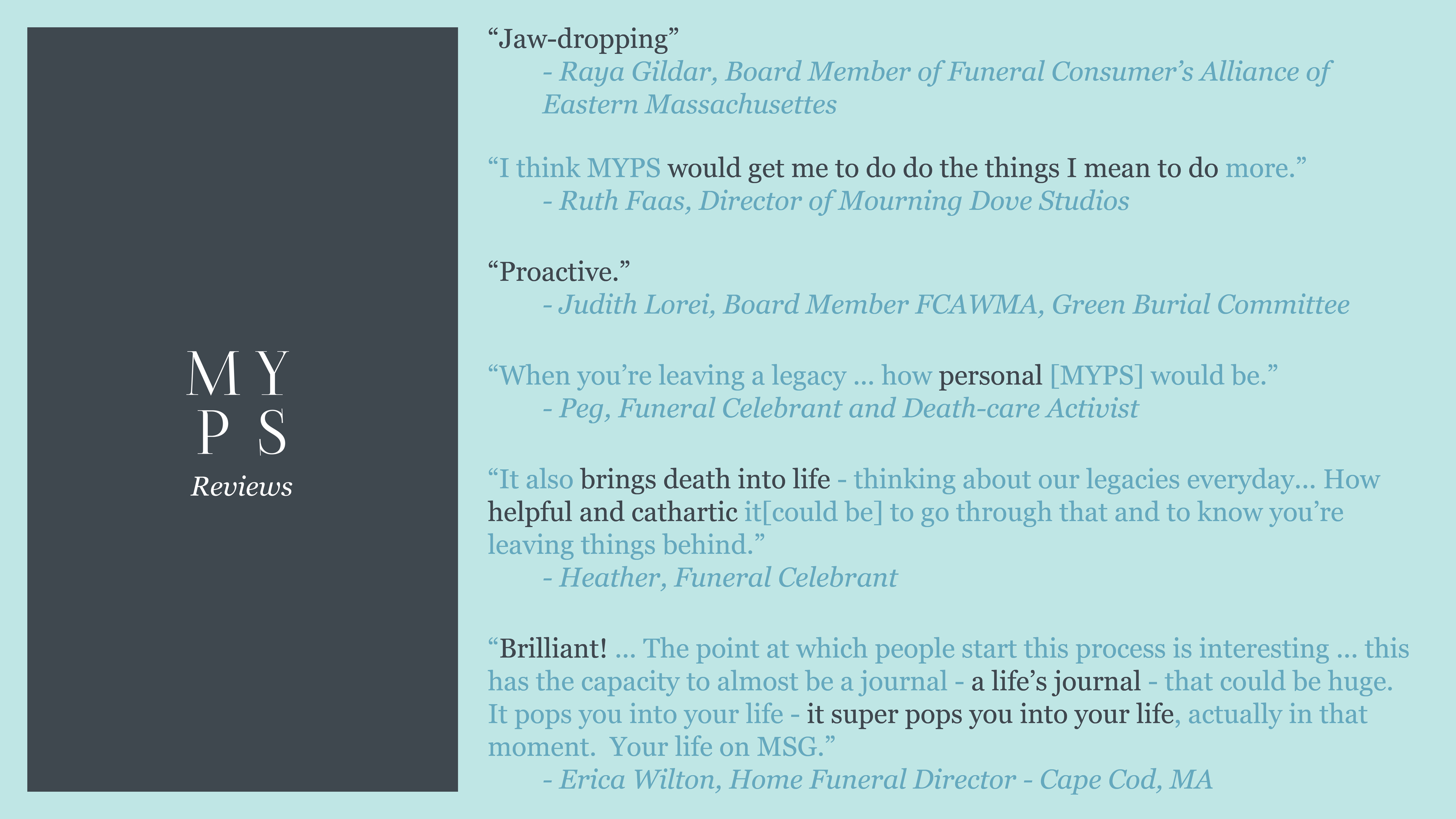
I was invited to participate in a networking event by Ruth Faas, my main contact in Boston’s death-care industry, on December 8th in Arlington, MA. Attendees included board members of both the Eastern and Western Massachusetts Funeral Consumer’s Alliances, Grief Therapists, Artists, Funeral Celebrants and Funeral Directors. Here’s what they had to say about MYPS…
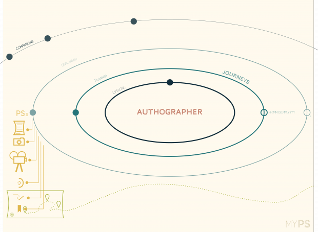
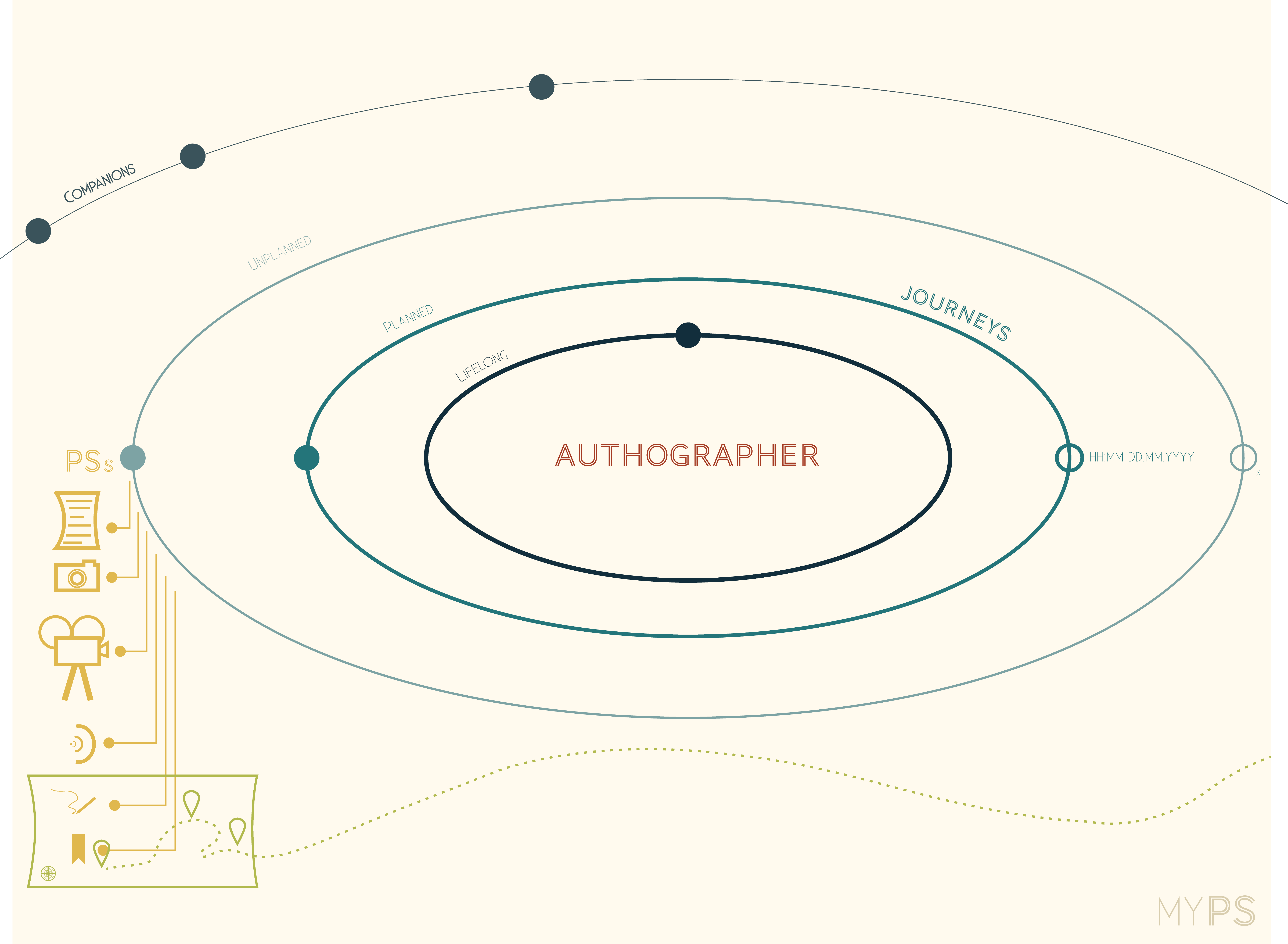
A graphic representation of the structure and terminology of the MYPS application.
When using MYPS, the authographer (author + cartographer) links each PS they upload to a “Journey”, which will be compiled into a map with the geotagged messages and sent to the listed recipients. The preferences for each journey are set up by the authographer when the journey is initiated, including the contact information for the recipients and the intended length of the journey. The lifelong journey cannot be closed until the entire account is deactivated; the planned journeys have established dates when they will close, and the unplanned journeys can be closed manually at any time. Your companions are the journeys fellow authographers have sent to you.
Deactivation and recipient contact information are controlled and updated, respectively, through periodic emails. An e-prompt will ask you once every 3 months to update your contact information, your recipients’ contact information, and to confirm your continued use. If the authographer does not respond to 3 successive prompts, the entire account will automatically deactivate. This can be disabled, temporarily, if the authographer does not plan on having e-mail or internet access for an extended period of time.
Each PS can be a note, a photo, a video, a recording, a sketch or a placeholder, which will allow you to revisit the PS and add a message later off-site, or simply remain as a “place” on the map.
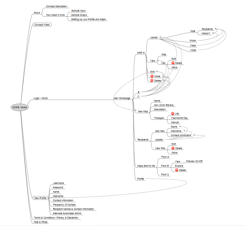
An outline of the user interface organization (using FreeMind software).
![]()
The Concept…
My Postscript is a cloud to ground cartographic composer that allows an individual to gradually create a map of messages for their loved ones to discover after the individual is gone. The process is incremental, both in design and delivery, so senders and recipients can handle the farewells at their own pace. A PS can be a note, picture or video and as small as a tweet or as long as a letter. Each PS is geolocated so recipients can visit (or happen upon) the place where the message was left for them and feel that much more connected to the sender.
The Prototype – MYPS v0.1 …
If you are interested in helping me develop MYPS, please send me an e-mail with your name, your intended recipients’ names and whichever of the following you are comfortable providing:
– your recipients’ contact information (e-mail or snail mail) if you want me to send them the maps directly
– your age (can be approximate)
– gender
– nationality
– current city
– religious, spiritual or philosophical affiliation
– any other information you think is relevant to your use of this prototype (are you tech savy? tech terrified? pragmatic? a hopeless romantic?)
Once I have your information I will send you the username and password for the blog so you can start posting. For each note, picture or video simply add a tag with the intended recipient(s) and as specific a location as you can give. When the trial is done I will compile the maps and send them to you or to the recipients if you provided their contact information.
Ideally these will be real messages for real people so that I can get a better sense of how MYPS would be used in the real world. However, silly messages to fake people, silly messages to actual people and sincere messages to fake people are also acceptable (and may help me add humor to my final presentation at the end of the semester).
** This is currently in a blog format so that the posts are easily editable and so your input format will be as close to the final version’s input format as possible – if you have privacy concerns let me know so you can e-mail the PS’s to me and I will keep them solely on my harddrive till the trial is over. Also, the Tumblr is not searchable so only other reviewers will see the content**
Feedback or questions are welcome at anytime through email or as blog posts. At the end of the trial I will send participants a short, optional survey to see how I can improve MYPS for version 0.2
For those of you with smartphones, iPads, etc…
Feel free to post PS’s to whatever platforms you already use (twitter, instagram, facebook, flikr) with #myps2u and I will add them to the blog. Please make sure to tell me what platforms you use beforehand.
For those of you who want a more private option or do not blog, tweet, instagram, etc…
E-mail me your PS’s with the subject line MYPS and I will add them to the blog for you. Make sure to include an approximate location for each PS and an intended recipient. For example, “to Buzz Aldrin: Remember when we became the first people to walk on the moon – those were some good times! Location: West Crater, Earth’s Moon.”
Thank you for your help and feedback. Hope you enjoy MYPS v0.1
Jennifer Lee Mills
jmills@gsd.harvard.edu
 Although mortality is humanity’s common ground, the subject of death has become taboo and the spaces of death are treated with morose reverence that often excludes them from the public realm and society’s consciousness. Cemeteries no longer function as vital urban spaces; they are Terra Mortis, dead land, set aside to memorialize our loss. However, even more disturbing than this underutilized land is the waste generated by postmortem processing. Society’s efforts to produce an illusion of permanence after death has resulted in an industry that defies, consumes and contaminates nature at the cost of public health, environmental security, urban green space and our overall spiritual well being. My project asks if we can transform cemeteries into a common, fertile ground that allows people to understand death as an integral part of life. We will begin the session with a Death Cafe in the tradition of Funeral Celebrants – be ready for Death & Donuts!
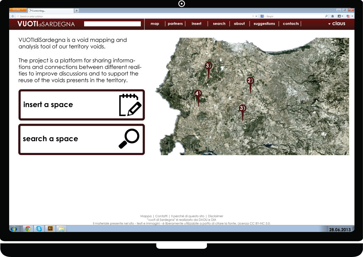
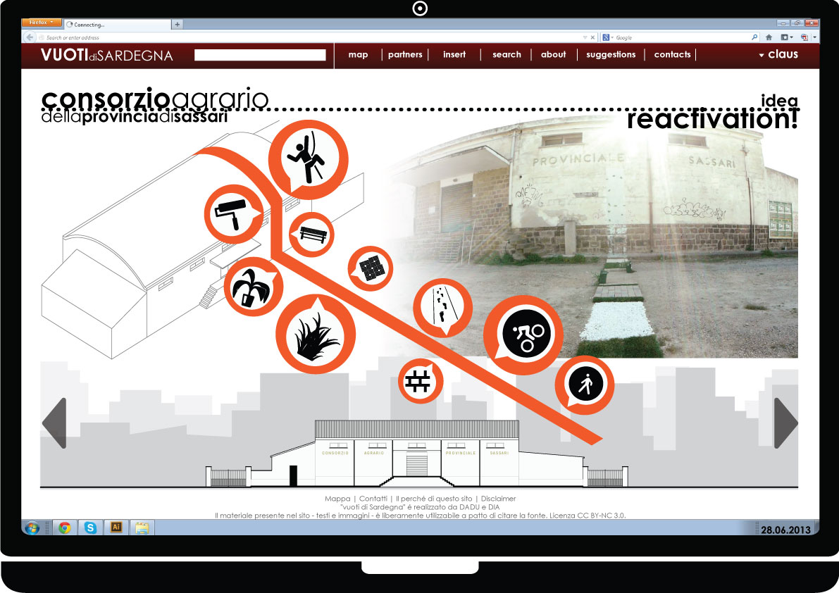
After our work resume, here’s our video for VUOTIdiSardegna, the Social Database for abandoned places in Sardinia.
VUOTIdiSardegna is a social database born to map the Voids present in the Nurra territory and in the rest of Sardinia, and to attract attention on them giving proposals about their possible future.

The project begins from the topic of the Void and its possible interpretations. After analyzing the Void concept in culture, art and architecture, we developed a personal vision of the Void culminated in the “City of Voids”, an ideal city where every cluster corresponds to a different Void declination; in general, the Void is conceived as dynamic and moving. The advancement consists in the Void research in the Nurra region; we investigated the Nurra history and we went to the different hamlets to meet people, in order to understand how they feel the Void in their own territory: the result is the presence of the Memory Void in a context of Social Void. This outcome brought us to categorize these Voids as Potential Voids.
After the previous result and a deep research about the importance of building regeneration , we began the Void mapping, that led to VUOTIdiSardegna. The website is a platform that connects the different mapping voids realities already existing, and operating in the territory; the aim is to create the most complete database about abandoned places in Sardinia, thanks to the work of organizations like SardegnaAbbandonata and of every person and association, public and private, interested in contribute to the project. In fact, it’s a totally open website and this allows everyone to participate to the mapping process and the database construction, a social database because every attendee becomes a user linked with the voids and the other users.
VUOTIdiSardegna is set up as a tool thanks to which it’s possible to obtain different information layers about the Voids and make overlaps with them. In this way, the website facilitates the Voids use, in facts it connects empty space availability with any people need compatible with them. VUOTIdiSardegna is configured as a triple network: the Voids network, the Users networ and the Ideas network; they’re interconnected each other.
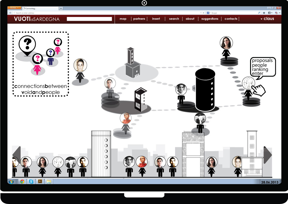
For every Void, it’s possible to see who are the users connected with it; for every user, it’s possible to see what proposal he made for that Void and for the others, and so on, in order to have connections and links between people, the Voids they mapped and the ideas they have for those Voids. In particular, every Void has its own page, where everyone – after the registration to the website and becoming a user – can make 5 simple actions:
- Add infos about the Void, contributing with images, videos and general informations
- See proposals made by other users for that Void
- Add proposals saying what the user wants for that place
- See what’s around, a list of similar examples
- See the action that was made for that void

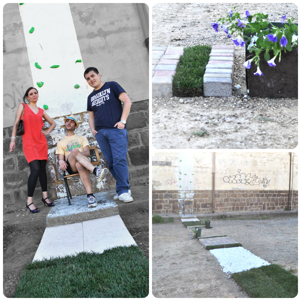
Focusing on the action, it’s a kind of intervention on the building, in order to show a possible new life for it. In particular, our action shot for the Consorzio Agrario building in Pozzo San Nicola, a village depending on the Stintino Municipality. Since it was impossible to refresh the whole building with no resources, we provided to reactivate just a strip of it with different operations along: wall whitewash, climbing wall, a bench, the greengrass, a flooring, a bricks flooring, a path, a bikepath and the sidewalk refurbishment.
In a 80 cm strip, we gave a snapshot of a possibility for the abandoned building. The hope is to make Nurra (and Sardinia) inhabitants aware of the importance of these places, for the memory that they carry on and for their worth not only in the past but also in the future.
Actually, the website is working. It’s a testing phase and it will be followed by its implementation. We guess that it could really represent an important tool for Sardinia and for Sardinian people.
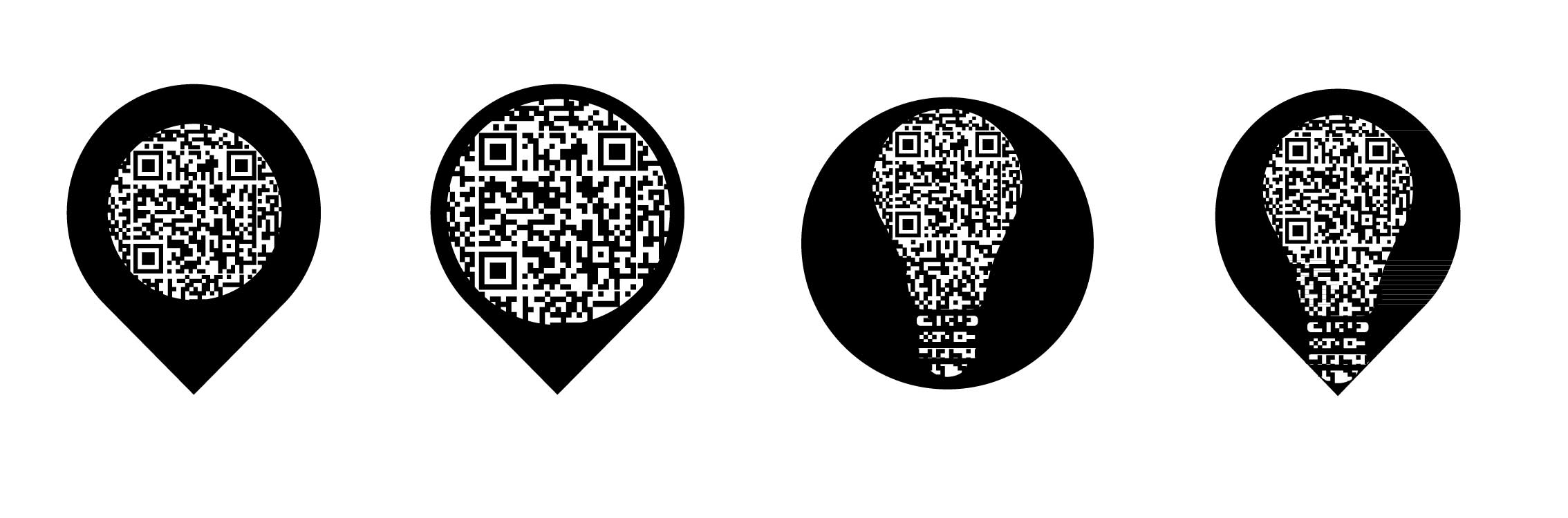
We have just to decide between one of these four hypothesis!
Any suggestion???
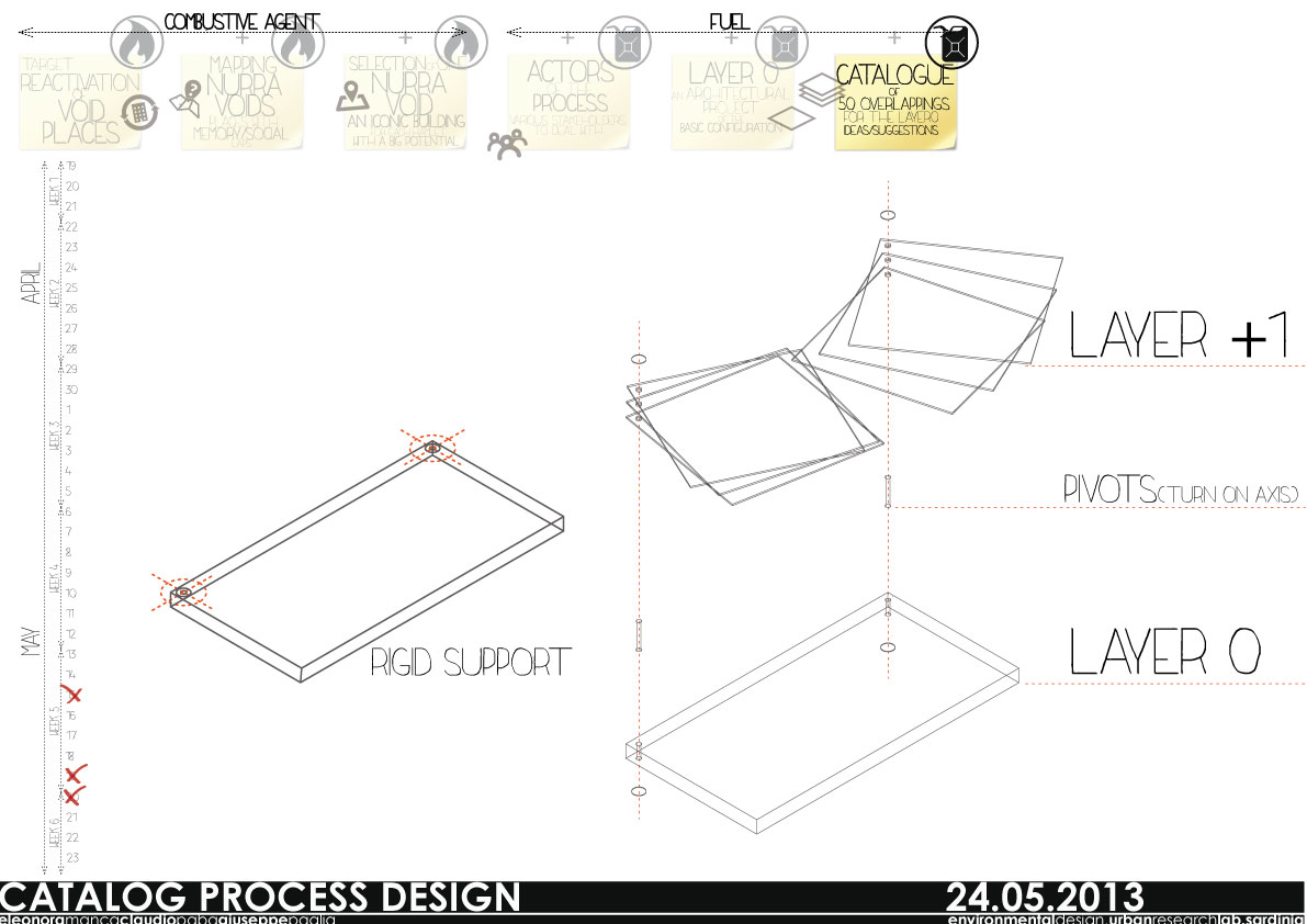
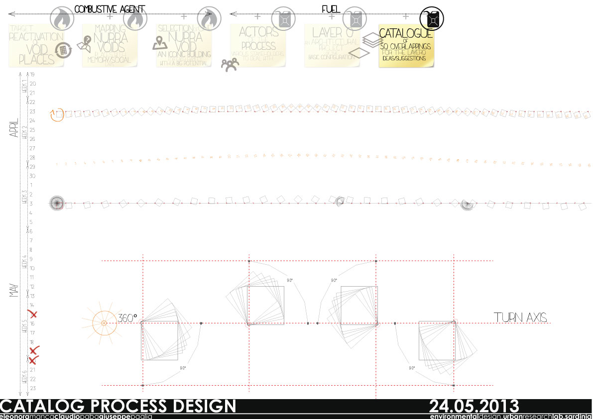
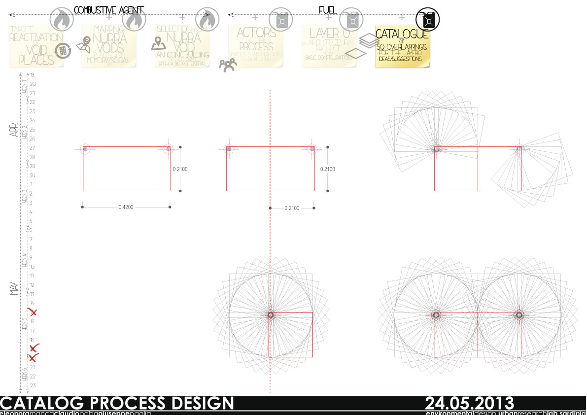
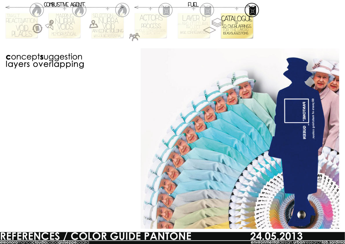
Following our general concept, here we focus on a single project tool: a catalogue of 50 ideas.
This catalogue grows out of an overlapping process, ultra-layers to apply to a basic configuration (layer O); physically is a book that plays with a rotation and overlapping of trasparent layers.
1 2 3 Next »