Networked Urbanism
design thinking initiatives for a better urban life
apps awareness bahrain bike climate culture Death design digital donations economy education energy extreme Extreme climate funerals georeference GSD Harvard interaction Krystelle mapping market middle east mobility Network networkedurbanism nurra nurraempathy placemaking Public public space resources Responsivedesign social social market Space time time management ucjc visitor void waste water Ziyi

Sardinia UrbanLab – Spring 2013
Master Studio carried on during the spring semester at the Alghero School of Architecture, Urbanism, Architecture and Design Department, University of Sassari. Exploring the Nurra Region in Sardinia, the territory with the lowest population density in Italy, with 5 inhabitants per km². This Region is facing important challenges in order to develop within a sustainable model. Resources, waste, economy, social, mobility, landscape (natural+man made), urban voids, digital layer,… are the topics chosen as a starting point for a deeper understanding of the actual reality and future challenges of Nurra.
An investigation has been launched into the use of aeroponics on a trellising system. The system needs to incorporate the filtered water that runs through the site into the cistern in the basement or ground floor of the parking structure. The size of the filter is being worked to find the most efficient yet smallest scale possible. If the filter is able to be incorporated into the structure to educate the public, more awareness would be made of the cleaning of the stormwater that the ramp is providing. This would also bring awareness to the topic in general, hopefully inducing more stormwater management across the board. The weight of the structure will be swapped for the installation of the water management system. Guard rails made of concrete are able to be removed and replaced with a structure that will house the vegetation system. This system will also provide the amount of safety the city of Portland requires by code.
This past week we dug deep into developing and defining the community engagement process we think applies to our apartment type graphically. We created a pamphlet to bring to local businesses who we thought might want to contribute to our efforts:
Apartment type and city wide locations further identified:
Creating temporary pedestrian infrastructure and use within underutilized parking spaces
(Action Plan and Continued Research)
The goal is to bring the public together, so people have the potential to engage and learn. Eastport Plaza is already a heavily used consumer destination. Customers will walk, bike, take public transit and drive to Eastport plaza, but it lacks pedestrian accessibility and character. Of the businesses on site surveyed 10-50% of the customers walk or take public transit. The parking lots are designed for efficient movement and storage of the automobile, not the pedestrian. The space will be temporarily sculpted for the pedestrian without infringing on the automobile accessibility.
I propose to design a business plan for the businesses of Eastport Plaza. This will be in a brochure format.
This site plan shows connections to parks around the neighborhood and calls out certain areas that are underutilized. These parking areas will be temporarily filled with community related uses and special events.

Mapping of Amenities

Mapping of Parks and Connections

The parking lot has the potential for innumerable different uses. Initially implemented programs would be based upon educated speculation. Over time the community can suggestions as to what they would like to see in within their commercial center. Some uses would relate more to the neighborhood, and act as destinations whereas other would be more temporary with their engagement and therefore could interest both shopping commuters and the neighborhood.

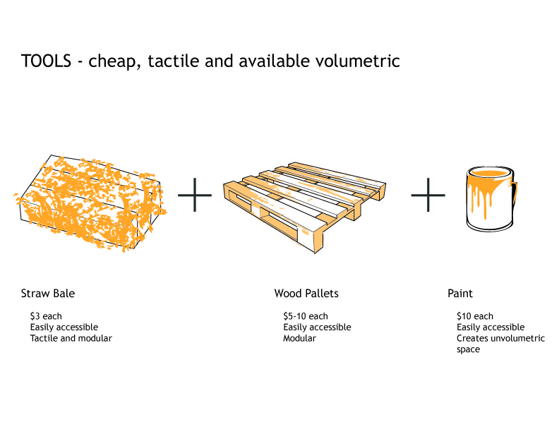
The space will be temporarily redesigned for the pedestrian using cheap and accessible items such as hay bails, wooden pallets and paint. This temporary pedestrian development will connect the pedestrian throughout the site and beyond to amenities in the area.
What makes a “successful” community?
There are many answers to this. The people, the culture, the built environment, the local businesses, the public spaces, community centers, social engagement, neighborhood “branding”, ect… One could spend all day arguing how one aspect is more important than the others in the creation of the elusive capital c “Community”. My research has led me to explore several neighborhoods that, on the surface, appear to have all the required pieces for a successful Community. One such neighborhood, and the site of my proposed project, is the area immediately surrounding Elmonica Station in Beaverton, OR.
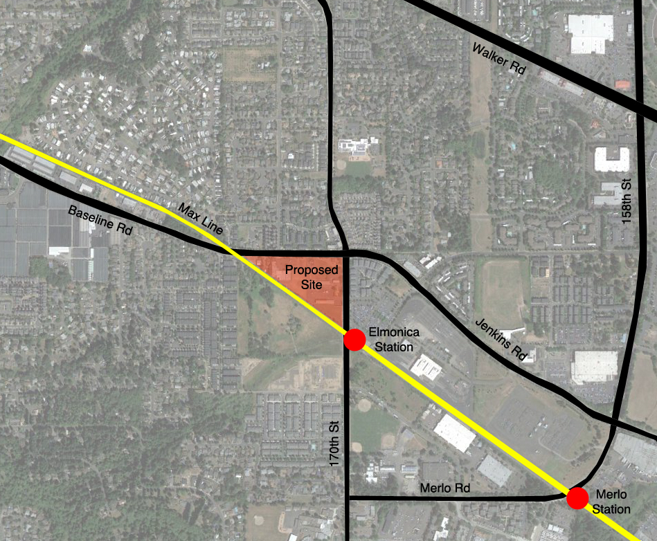
The surrounding area has many positive attributes. Proximity to major arterials, abundant available green space, mostly walkable streets, proximity to transit station, young and active resident demographic… But there are several issues that are preventing this area from being totally successful as a social community. They are:
-Lack of active public spaces
– Lack of casual dining/shopping
– No evening entertainment/Local affordable dining
-Baseline/Jenkins Rd Extremely wide, and speed limit is too high
-No active street front along nearby businesses
What this area is lacking is an active core development, and real public places. People inherently are driven to gather, and establish groups. However, with today’s car based culture keeping us in little bubbles whenever we leave the house, opportunities for casual social engagement are slim. A mixed use community/residential/business/retail development can be an active business center while providing active public spaces for people to use for social engagement within their neighborhood.
Moving Forward:
I need to complete several steps to determine exactly the blend of mixed use that is most appropriate for this site. Further analysis of local demographics and business mapping can show what specifically is lacking in the neighborhood. I also need to get in contact with Trimet to see what their current “vision” for the site is. Zoning is already set up for high density mixed use development, so there is no conflict in that area. After I complete these steps, I can begin to draft a development plan for the site.
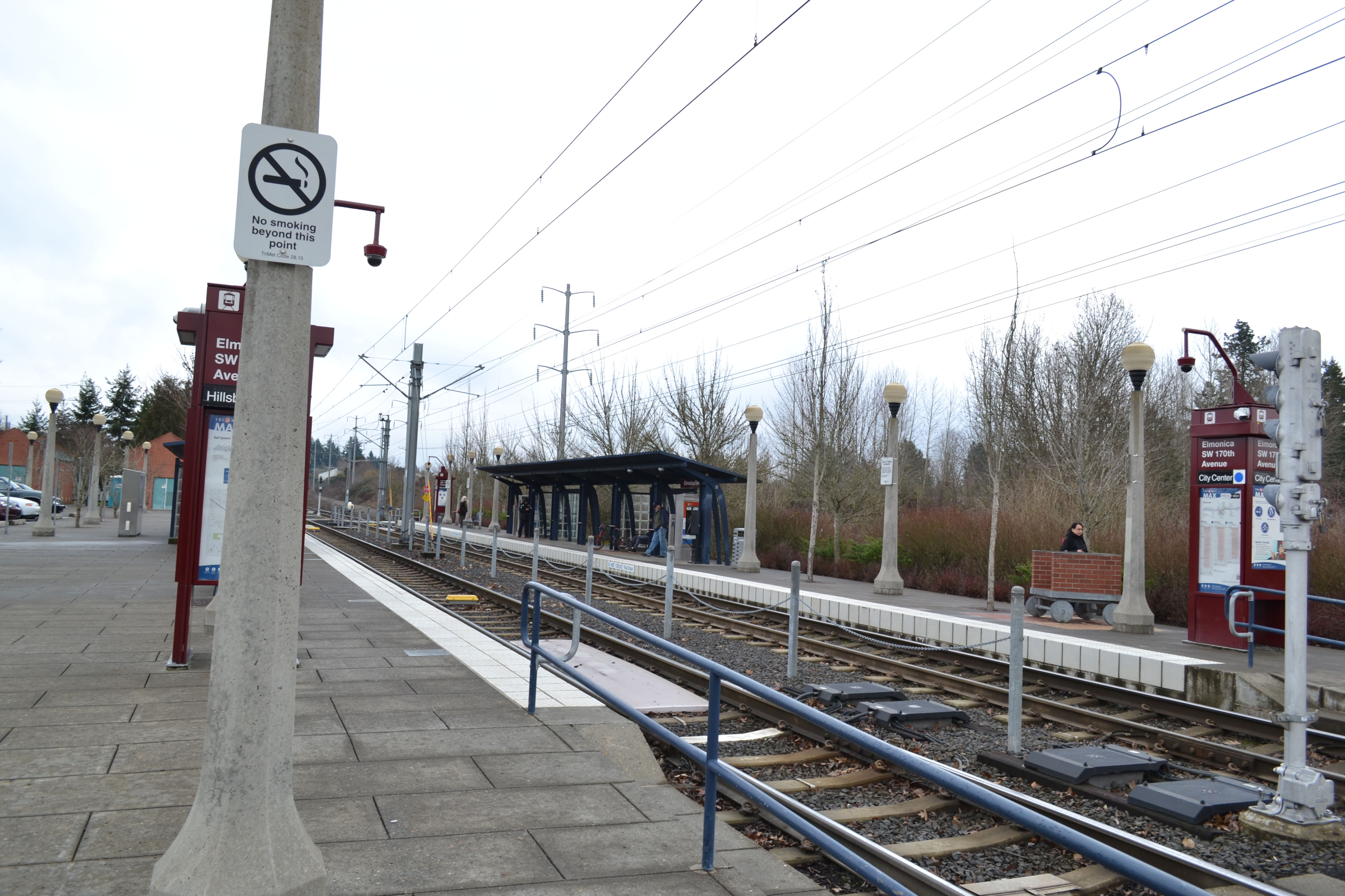
Elmonica Station, near South corner of proposed site
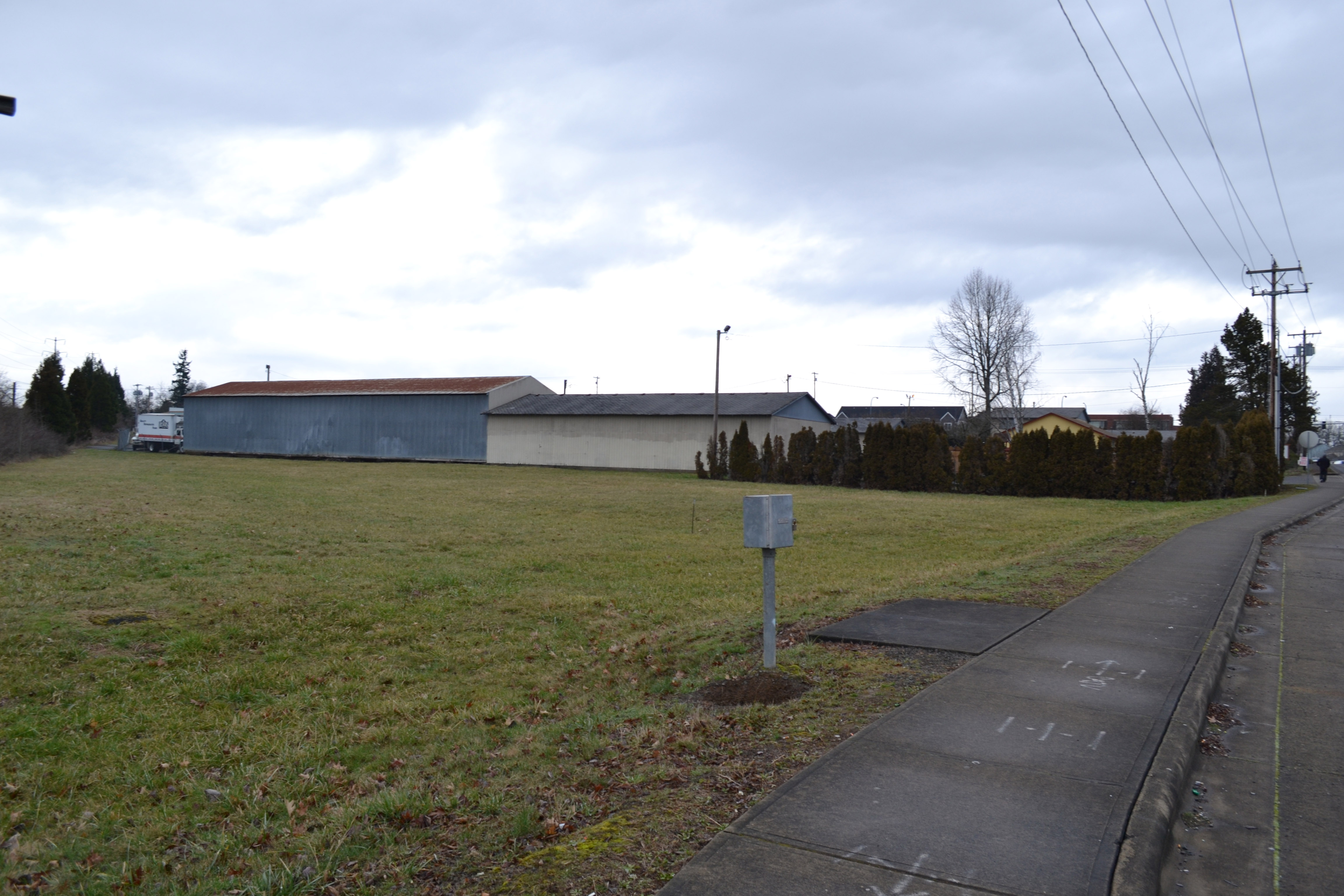
South coner of proposed site, current buildings mostly consist of vacant light industrial warehouses
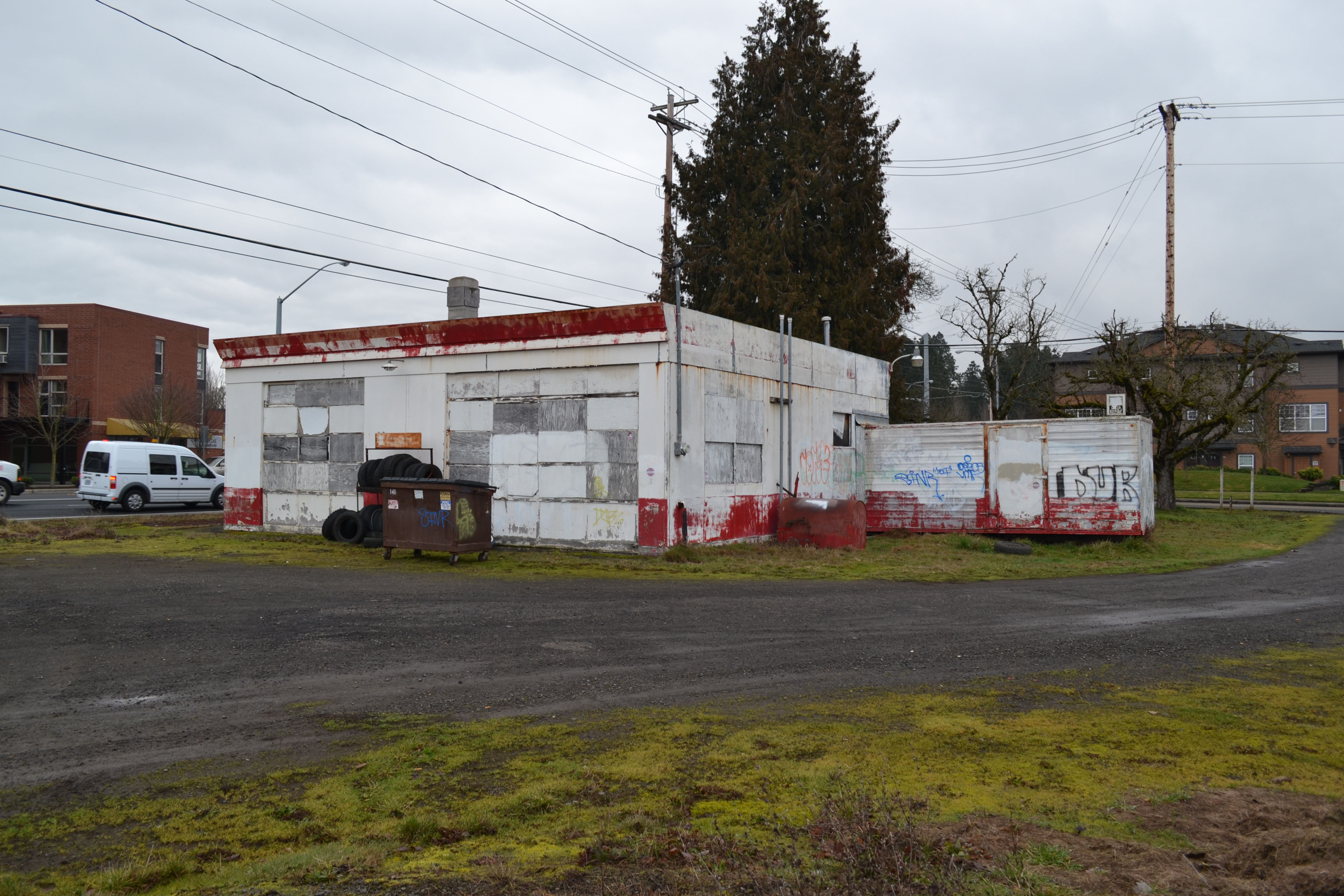
NE corner of proposed site, derelict structure borders arterial and sits across from small retail development
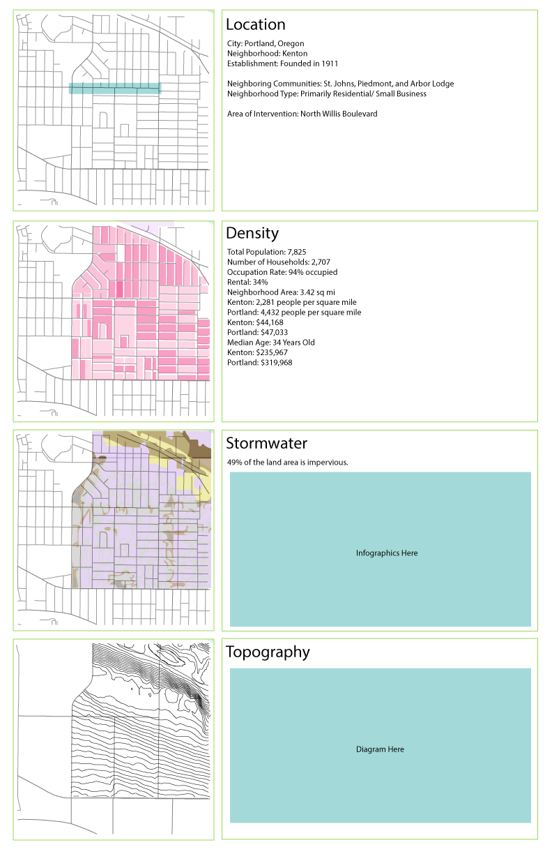
As a result of streets with missed opportunities in Kenton we decided to intervene on Willis Blvd, potentially at the intersections of N Fowler and Washburne Avenues. As most streets that are designed as collector streets [streets primarily used to carry traffic from local to arterial streets] are typically no more than 60 feet wide, Willis is a total of 96 feet. The extra square footage are grass islands and sidewalks.
43% of the Columbia Slough Watershed is natural area and we want to use those strong natural systems to inform our design decision. To do this we have decided on greening the blocks along Willis Blvd as stated above. Our large-scale bioswale intervention will help to raise awareness of the importance of these systems by engulfing their commute with natural systems, whether it be via foot, bicycle or car. By strategically implementing various types of green systems we will be able to control stormwater runoff, enhance the quality of life, and create community engagement opportunities.
The next step in our project process will be to further refine our intervention typologies and placement, our narrative and to make a clear and concise argument for what makes our project relevant to the neighborhood of Kenton. Below is the start of refining our project — all images are works in progress and may not reflect all the research we have collected over the term.
In entering into design we asked two main questions.
• How do we address the problems of this type?
• How do we do this while maintaining identity and discouraging displacement?
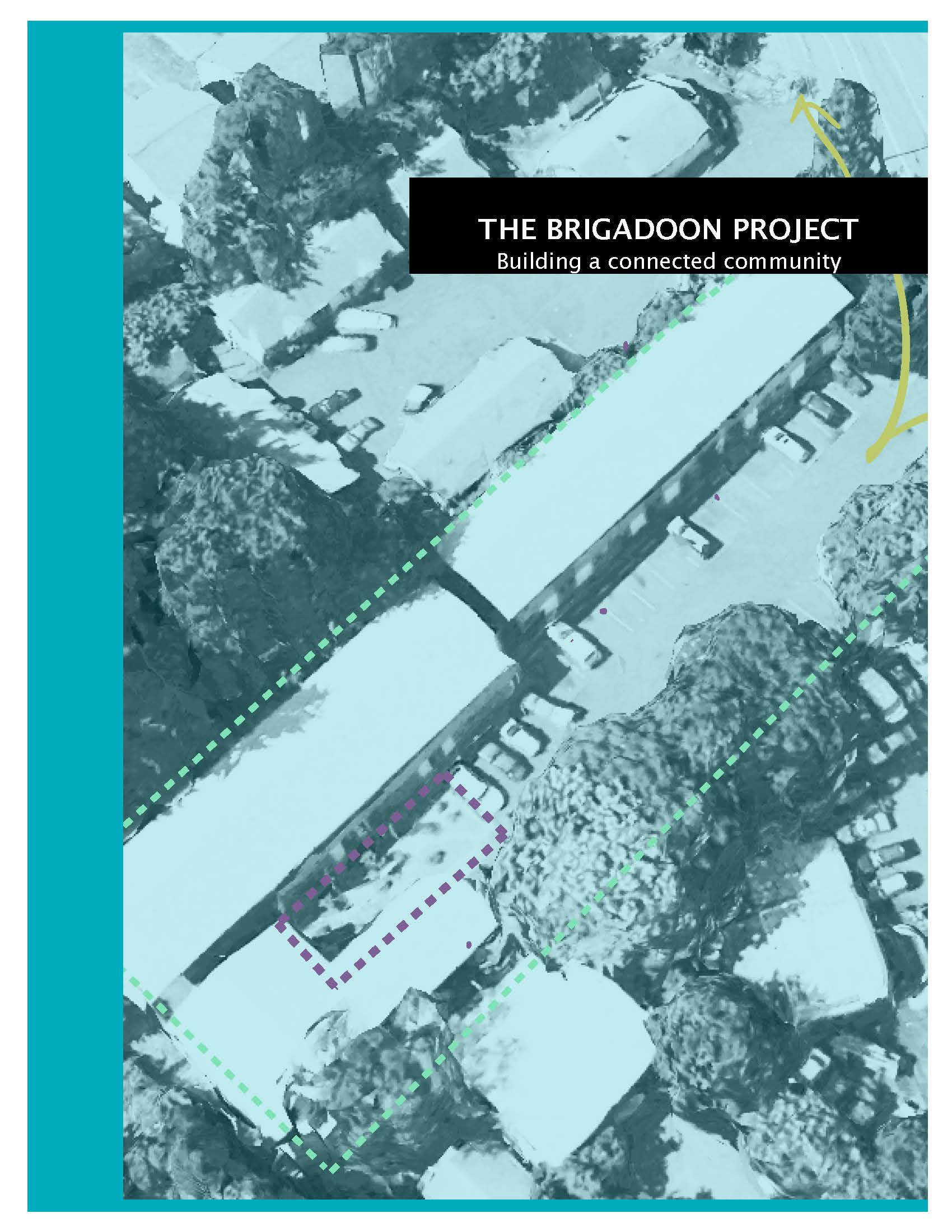
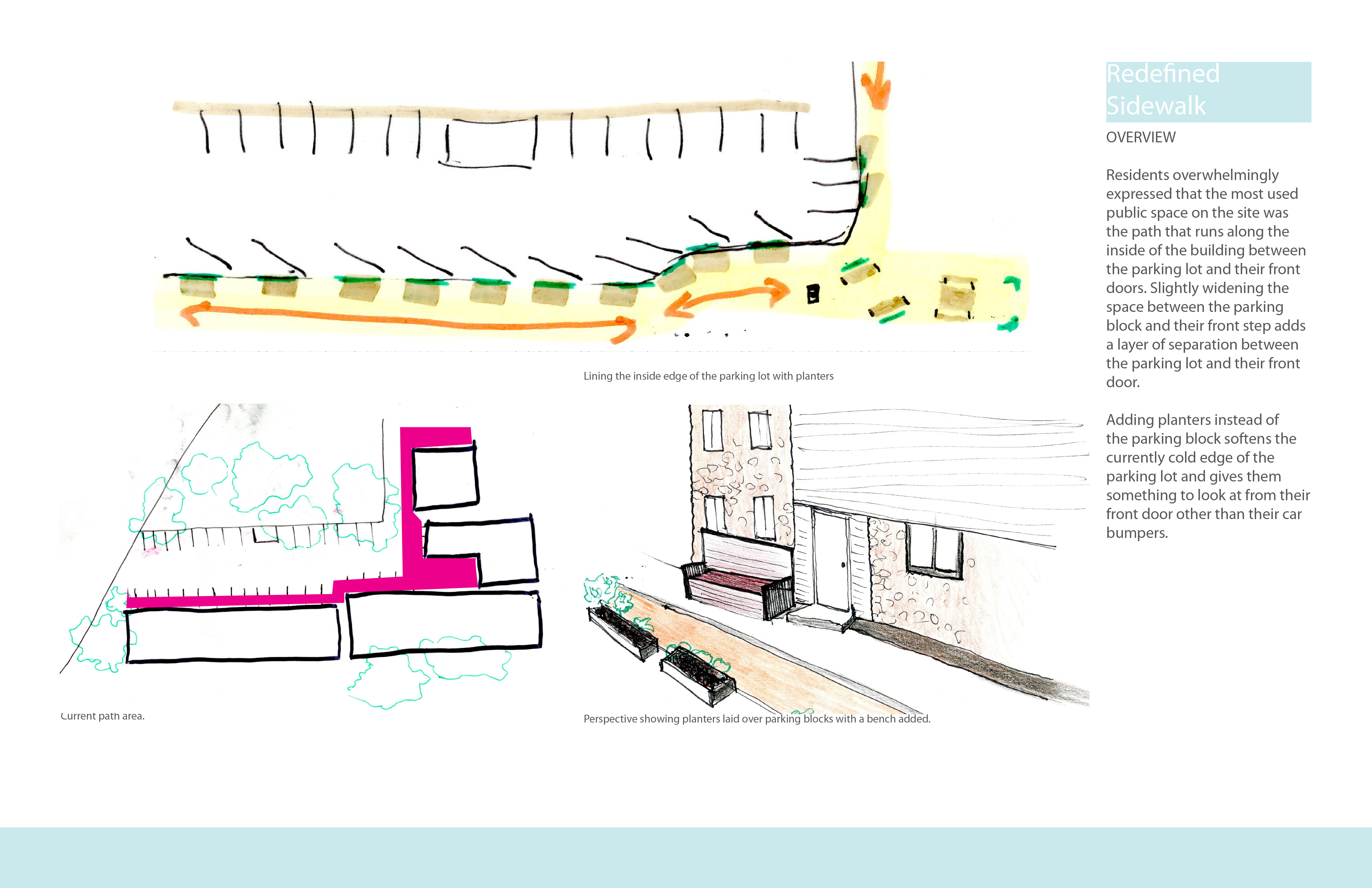
We put together a questionnaire to ask the residents about their space. The feedback we got was valuable and the tenants gave us a lot more information than expected. The designs presented are informed by the feedback from the residents of Brigadoon and how they currently use their space.
Progress
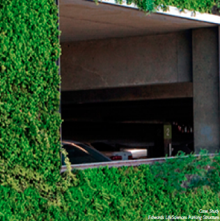
Water is a growing concern amongst the cultures of the world. Here in the northwest there happens to be an abundance of water at the time. This will not be the case for long as global warming and pollution have created awareness that our actions are finite. As new construction techniques continue to advance, a major design function is the rainwater capture on site. By containing the water that falls upon the site or structure, that water is able to be used for irrigation and other activities depending on the infrastructure set up to handle the water. This saves the owner from having to purchase water that is being brought in from off-site (as the city has to import water from the mountain range having outgrown the natural reservoirs, and built impervious surface to keep from replenishing through the natural hydrologic cycle). One of the largest carbon footprints of impervious surfaces are parking lots and ramps that make up the majority of non commercial or residential use lots. These ramps contain the most potent pollutants as cars are one of the biggest threats to the environment. The dripping of toxins and exhausting of carbon dioxide (amongst many other pollutants) at idle, starting, and driving, all collects in the lots and ramps. The rain water then washes those pollutants into the storm water drains, which until recently fed directly into the river. The Big Pipe project in Portland helped to alleviate some of the tension on the system and began separating the waste from residential and commercial use from the storm water drains. This was crucial as overflow situations created a torrent of black water material rushing into the river untreated. Although this will work for now through the Big Pipe size increase, as time has taught us, we will again outgrow the old system and need to find a new way of dealing with water.
Parking ramps are a perfect place for intervention as they contain some of the most unhealthy environments, but are also a way of our daily lives (and not being replaced anytime in the foreseen future). Incorporating an adaptable structure that would capture the rainwater, treat and purify, then reuse it for vegetation on site will help to mediate the air quality in the area. To do this a phase-able system is needed. The size needs to be able to vary and fit all types of ramps across the city. A canopy like structure that sits above the cars can act as shade, (alleviating the excess heat ramps create) rainwater protection, (keeping people dry as they go to and from their cars) and rainwater capture devise (starting the purification process), as well as being aesthetically appealing to all as nature has proven to be a healthier environment then plain concrete buildings.
The project at this time consists of a collection of statistics that describe the rain fall in Portland, the taxes on not capturing rain water, incentives to capture rainwater, the size of the systems needed to cope with the amount of water on each particular site, as well as the codes that can help to push the cover to 50% of the top floor of each unit with vegetation within the next few years. (this is currently being enforced on new parking surface lots.)
The type of filtration system is being analyzed with the help of some agronomists and green wall experts. The goal is to find the correct vegetation that will be the most beneficial for the environment as well as be aesthetically appealing and economical. Also the plants ideally will grow on a hydroponic system that will be designed and incorporated with the canopy coverage as well as the vertical gardens to keep the overall mass of the installation to a minimal. Interviews are being conducted with a local planner, agronomists, as well as the parking lot owners and attendees to find out more information.
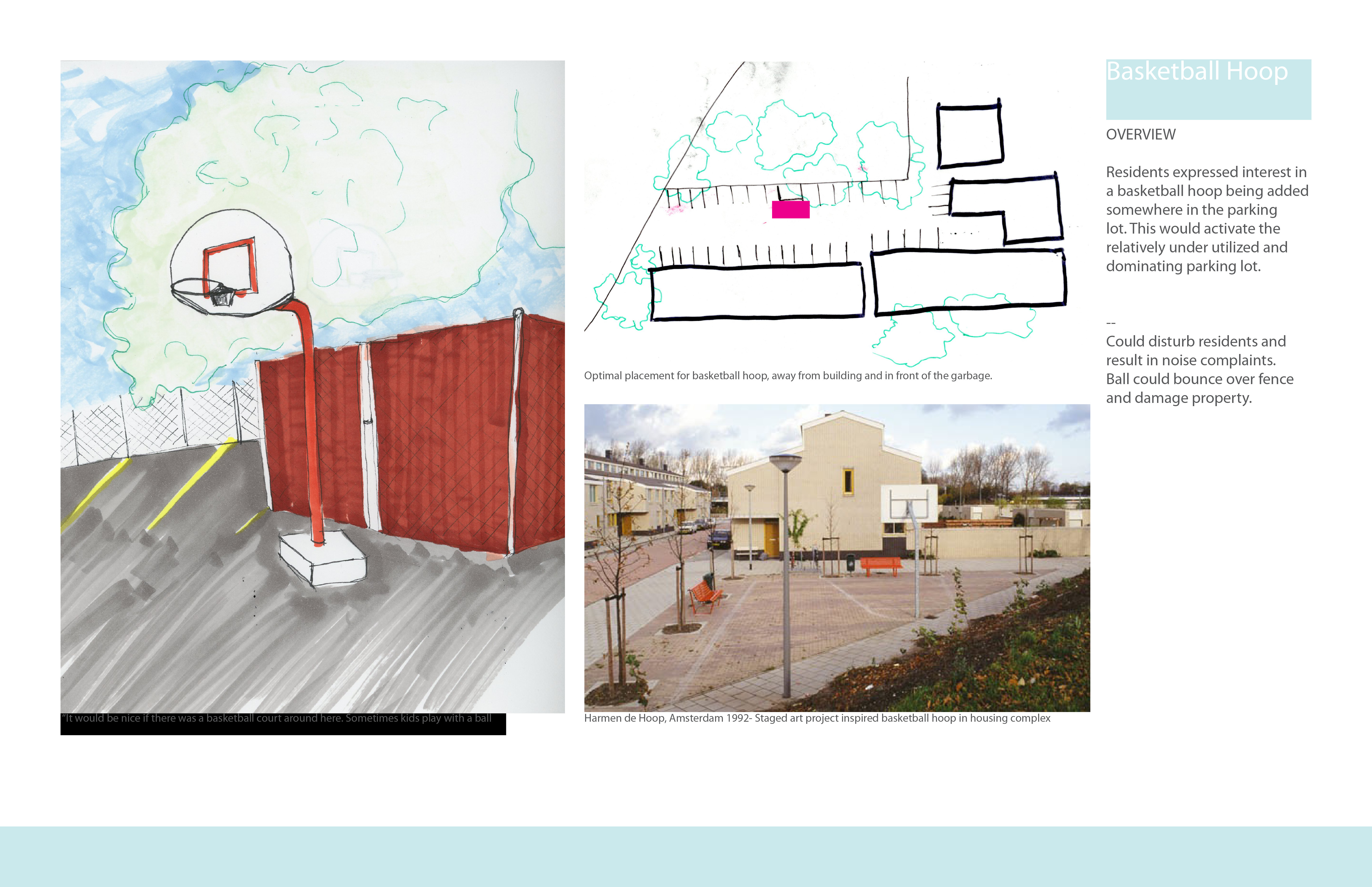
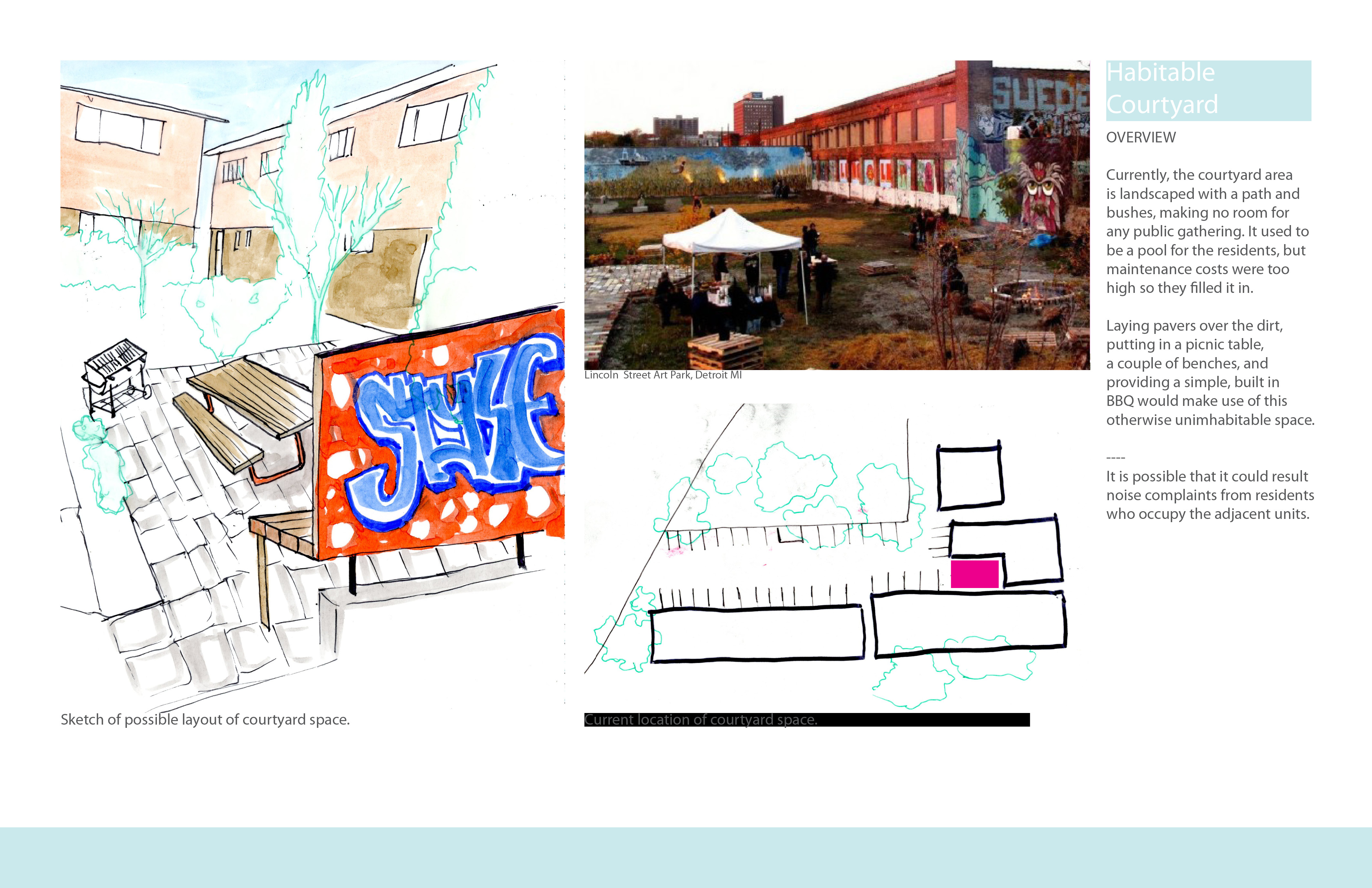
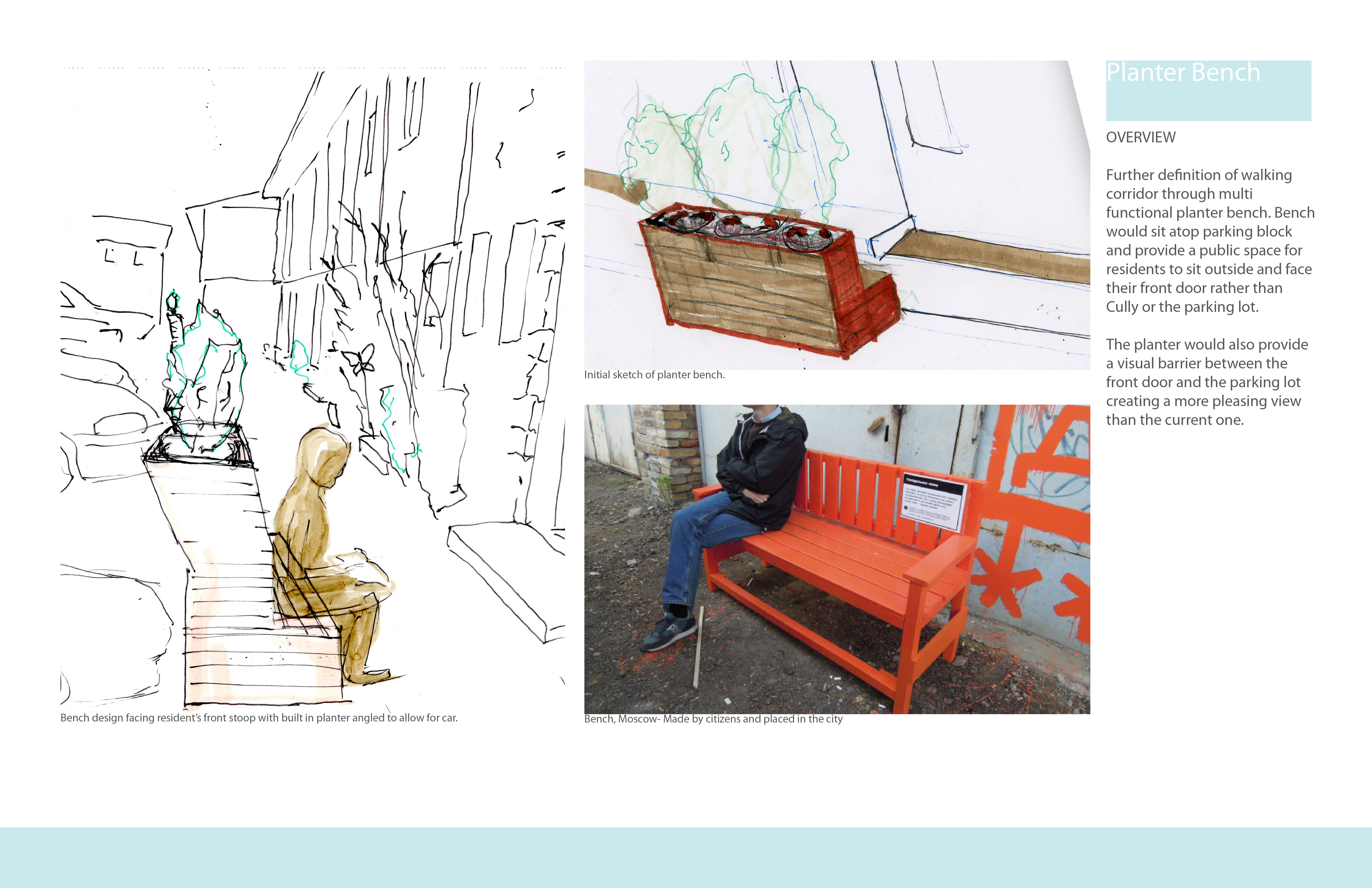
We are addressing the issue of a lack of community space and neighborhood identity in many urban living environments.
The Type:
We started by defining 4 major factors present in an apartment typology we are looking at that negate social interaction between community members.
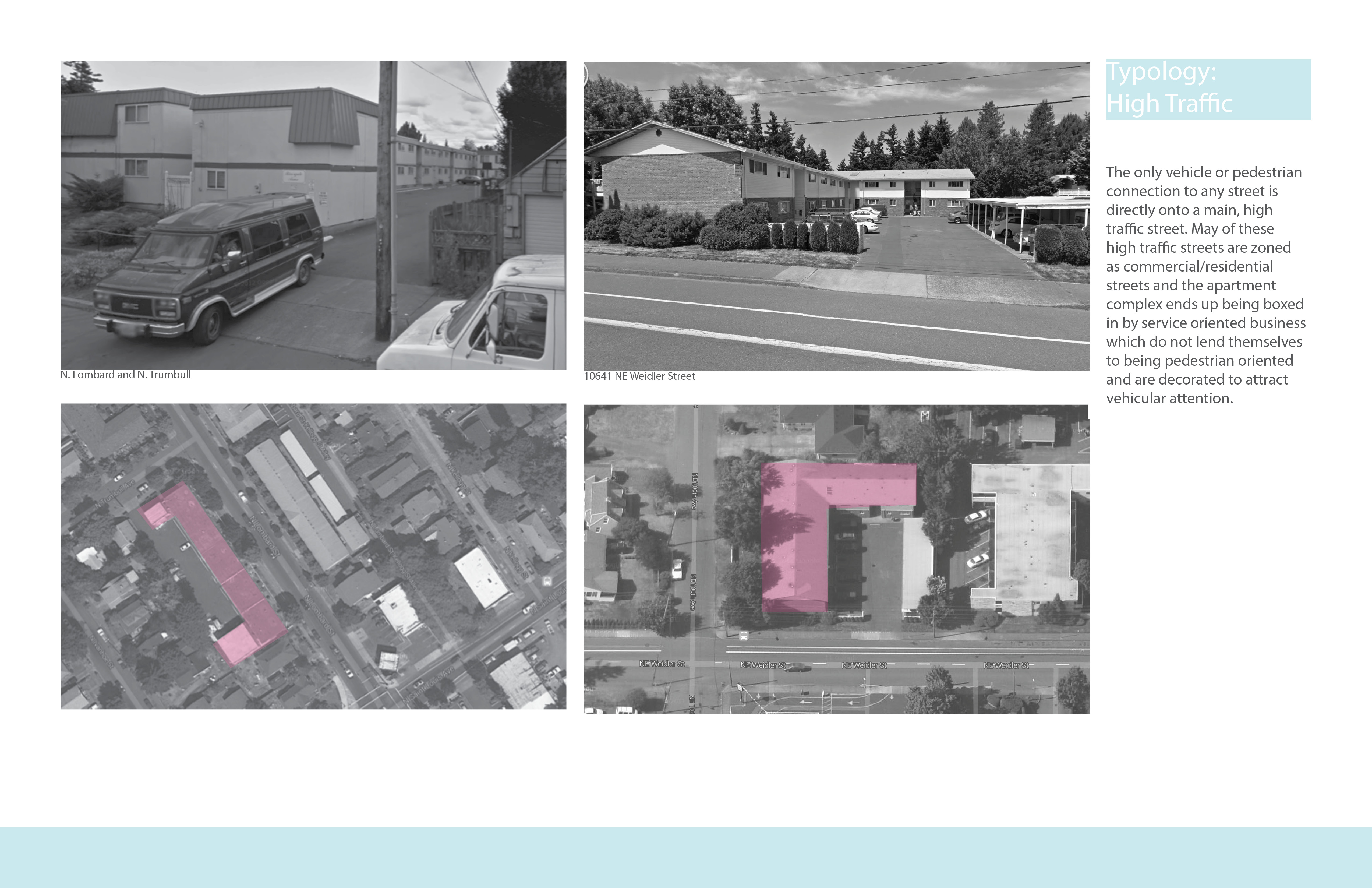
• The site being cut off from a larger neighborhood by having only businesses in your surrounding area.
• The site being adjacent to a busy street and having the main exit face onto that street, which makes the community isolated.
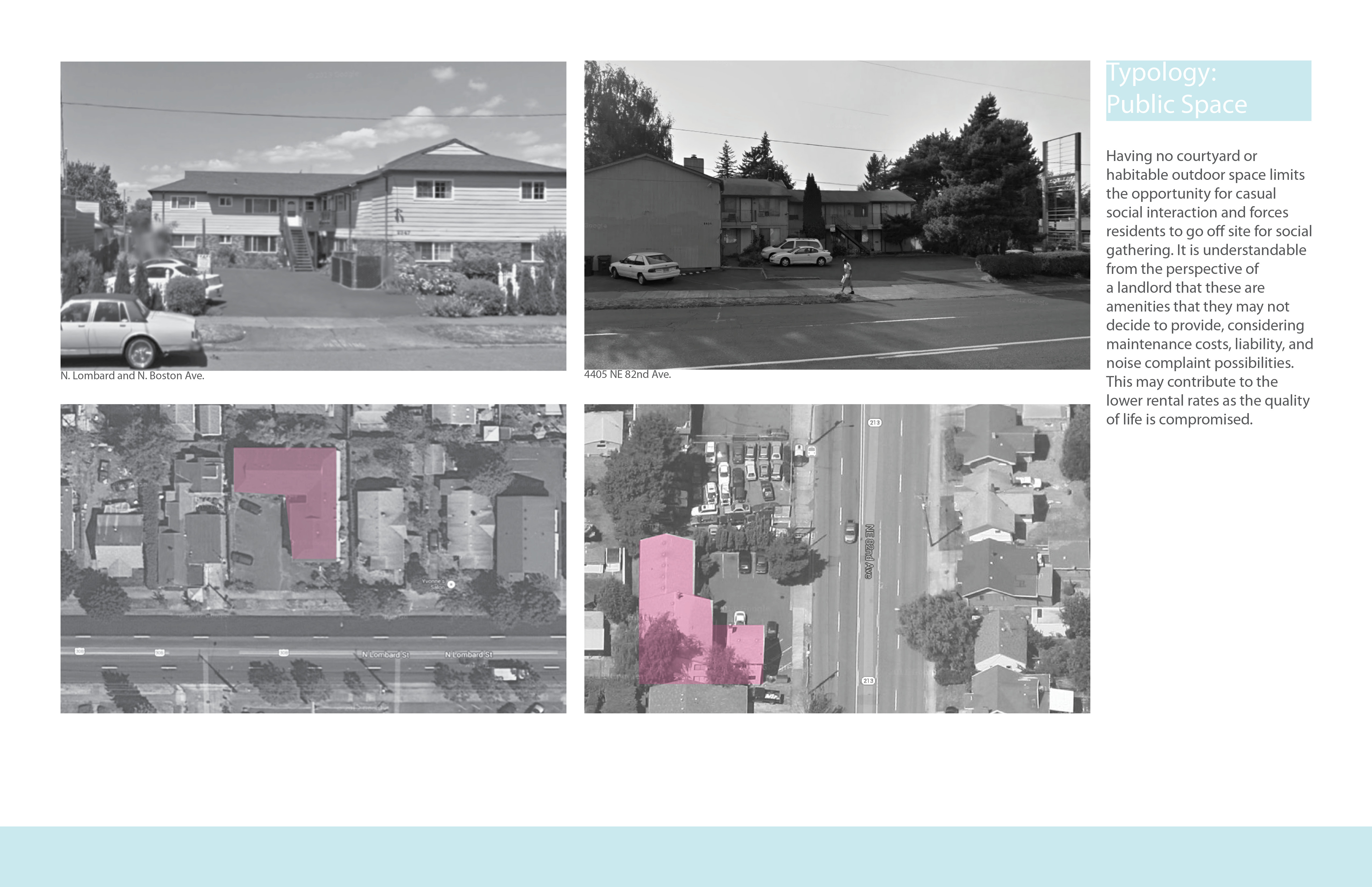
• The lack of shared community space.
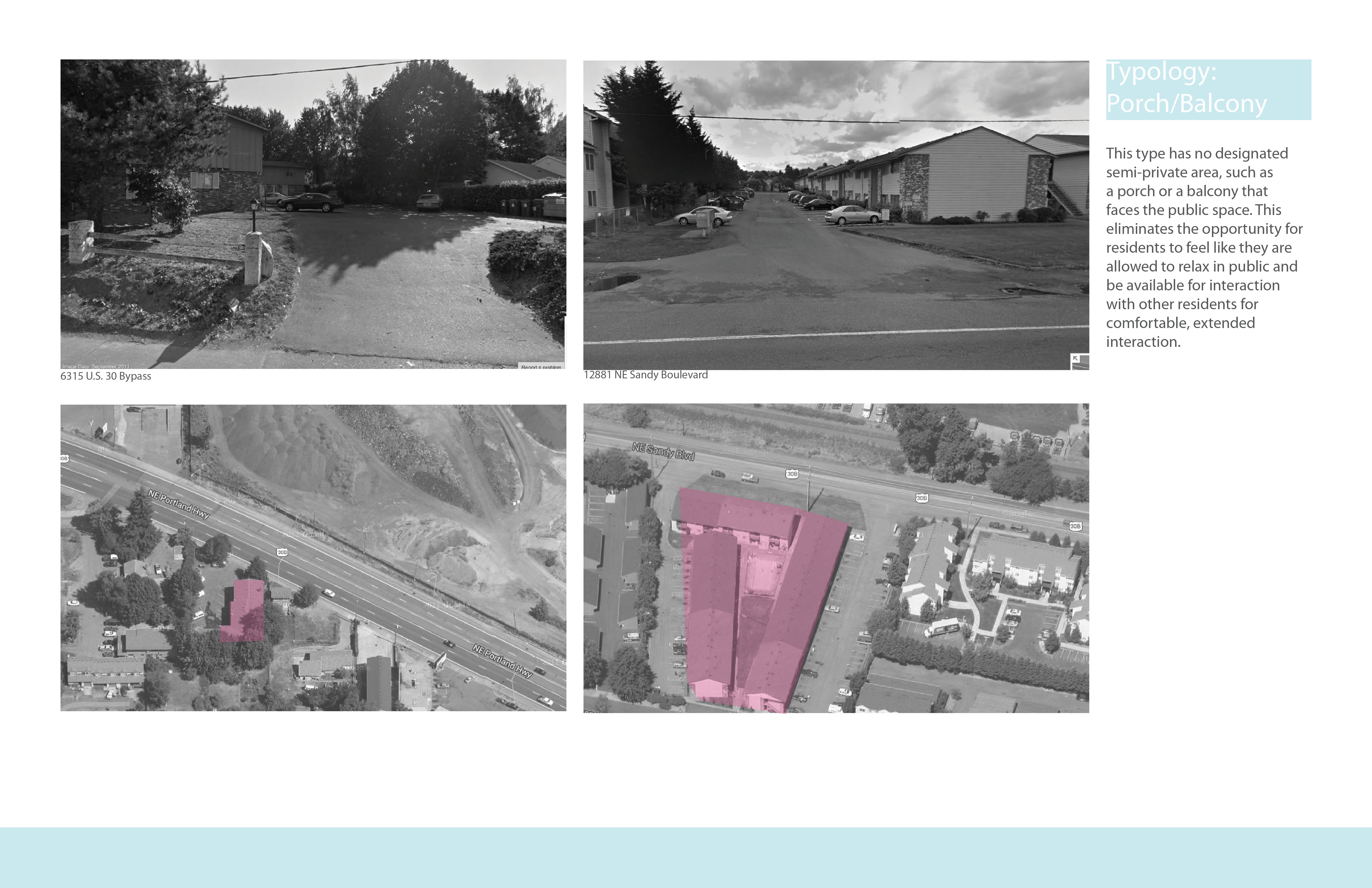
• A lack of usable space outside the entryway to homes that could act as social medium between the home and the rest of the community.
We choose to confront this typology through designing specifically with the residents of the Brigadoon Apartment complex in the Cully neighborhood of NE Portland.
Let’s face it: every person needs air to breath. Good air quality is important for human health and with the rising population growth in urban areas, it is vital to maintain a healthy air quality for urban residents. Yet, how many people know about the current air quality in there region?
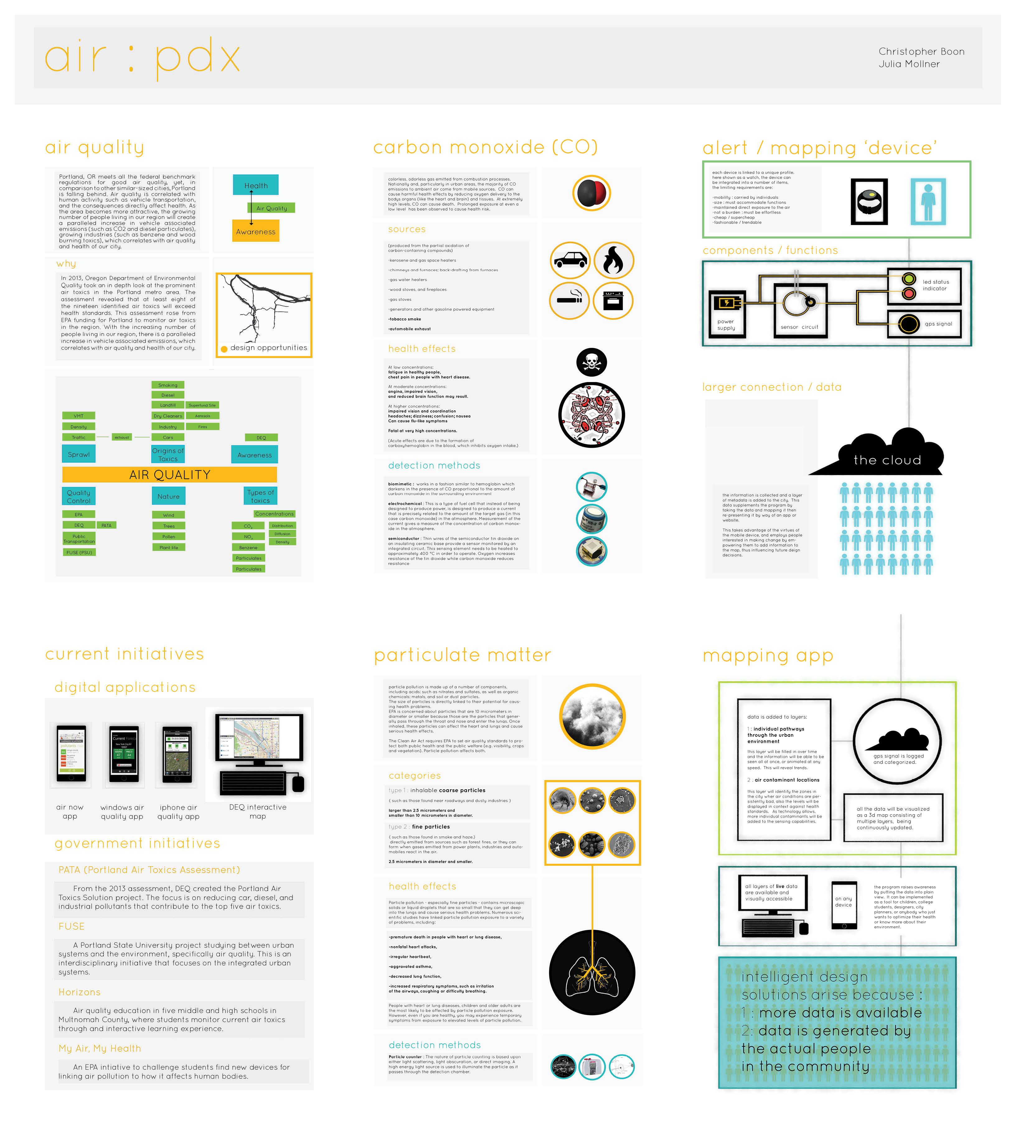
Portland, OR meets all the federal benchmark regulations for good air quality, yet, in comparison to other similar-sized cities, Portland is falling behind. Air quality is correlated with human activity such as vehicle transportation, and the consequences directly affect health. As the area becomes more attractive, the growing number of people living in our region will create a paralleled increase in vehicle associated emissions (such as CO2 and diesel particulates), growing industries (such as benzene and wood burning toxics), which correlates with air quality and health of our city.
In 2013, the Department of Environmental Quality (DEQ) projected the air quality for the metro area in 2017. This modeling was funded by the Environmental Protection Agency (EPA) and conducted by DEQ, revealed that at least eight of the nineteen identified air toxics will exceed health standards. This assessment rose from EPA funding for Portland to monitor air toxics in the region. DEQ identified the highest priority air pollutants. Air toxics such as NO2, CO, SO2, and diesel particulates were ranked the most important to reduce in the immediate future.
Our objective is to raise individual and group awareness of immediate air quality and the toxics in the air that affect daily and chronic health concerns. We aim to create a digital mapping interface that will analyze data from individual devices that are used by urban residents. This device, which is in development as to how it can monitor specific air toxics as a model for further toxic monitoring, will have features such as: a toxin sensor, a LED light which will illuminate when surrounded by unhealthy air levels, and a GPS tracker. The device will monitor one toxic to act as a surrogate which can be built upon in the future of monitoring other toxins. This is intended to give instantaneous notifications to the user of current air quality to immediate environment, as well as provide data to the mapping website. The website can be accessed by all and act as a comprehensive 3D model of air quality in correlation with human movement (understood through walking, biking, or driving).
The mapping interface can then provide insight into design intervention opportunities in locations where air toxins are the unhealthiest. By linking daily human movement with monitoring one air toxic, that contribute to a larger database of information, we can make more informed design decisions for new development and investment: we can create a healthier, more intelligent city.
From our pin up, the main concern was with the realization of a monitoring sensor that will be able to function in real life. Thus, the first step is to understand the technical aspects of monitoring sensors. To do this we are working with DEQ to understand the logistics of sensors and their accuracy. At the same time we will start creating the online map layers which will collect and represent the data in a user friendly manner and language.
« Previous 1 … 3 4 5 6 7 … 12 Next »