Networked Urbanism
design thinking initiatives for a better urban life
apps awareness bahrain bike climate culture Death design digital donations economy education energy extreme Extreme climate funerals georeference GSD Harvard interaction Krystelle mapping market middle east mobility Network networkedurbanism nurra nurraempathy placemaking Public public space resources Responsivedesign social social market Space time time management ucjc visitor void waste water Ziyi
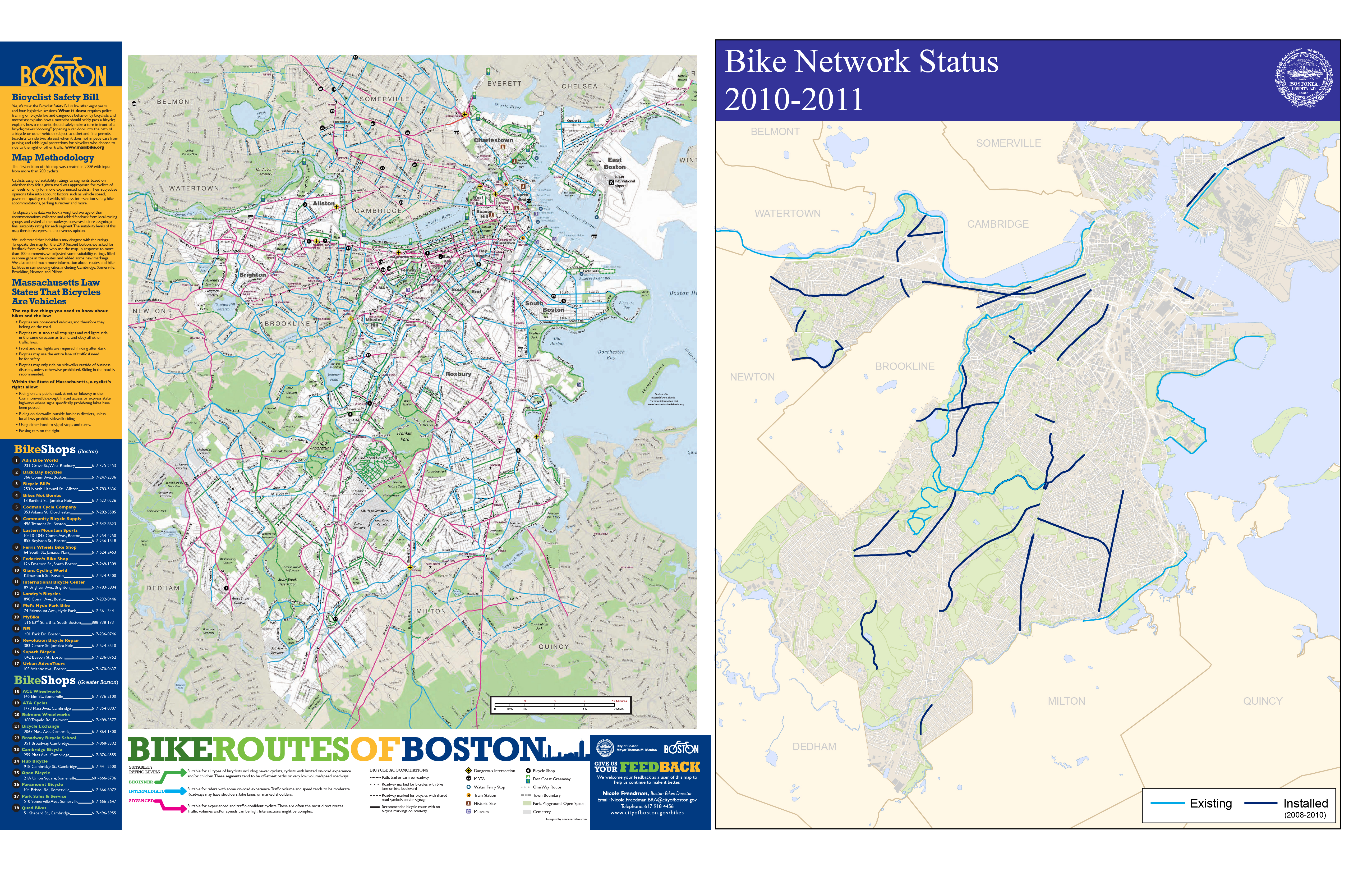
Riding a bike around the city of Boston you come to realize quite quickly that the cycle infrastructure is lacking. Even with the declaration by Mayor Menino that in Boston “the car is no longer king” and the cities recent focus on improving the cities cyclability, riding in the city is tough, scary and at times down right dangerous. The infrastructural improvements consist mostly of painted line bike lanes and Sharrows (painted bicycle arrows indicating an acceptable space within the lane a cyclist can occupy). While researching the current conditions I found that the mapping of the cycle infrastructure, and more the experience to be completely lacking. The maps of cycle lanes mainly consist of diagramatic overlays on plain google maps. I realized that there is not a map (at least I have not found one) that has the actual lanes drawn in. This type of mapping is deceiving to the rider as the system that exists is disjunct and rough with potholes and seamed pavement.
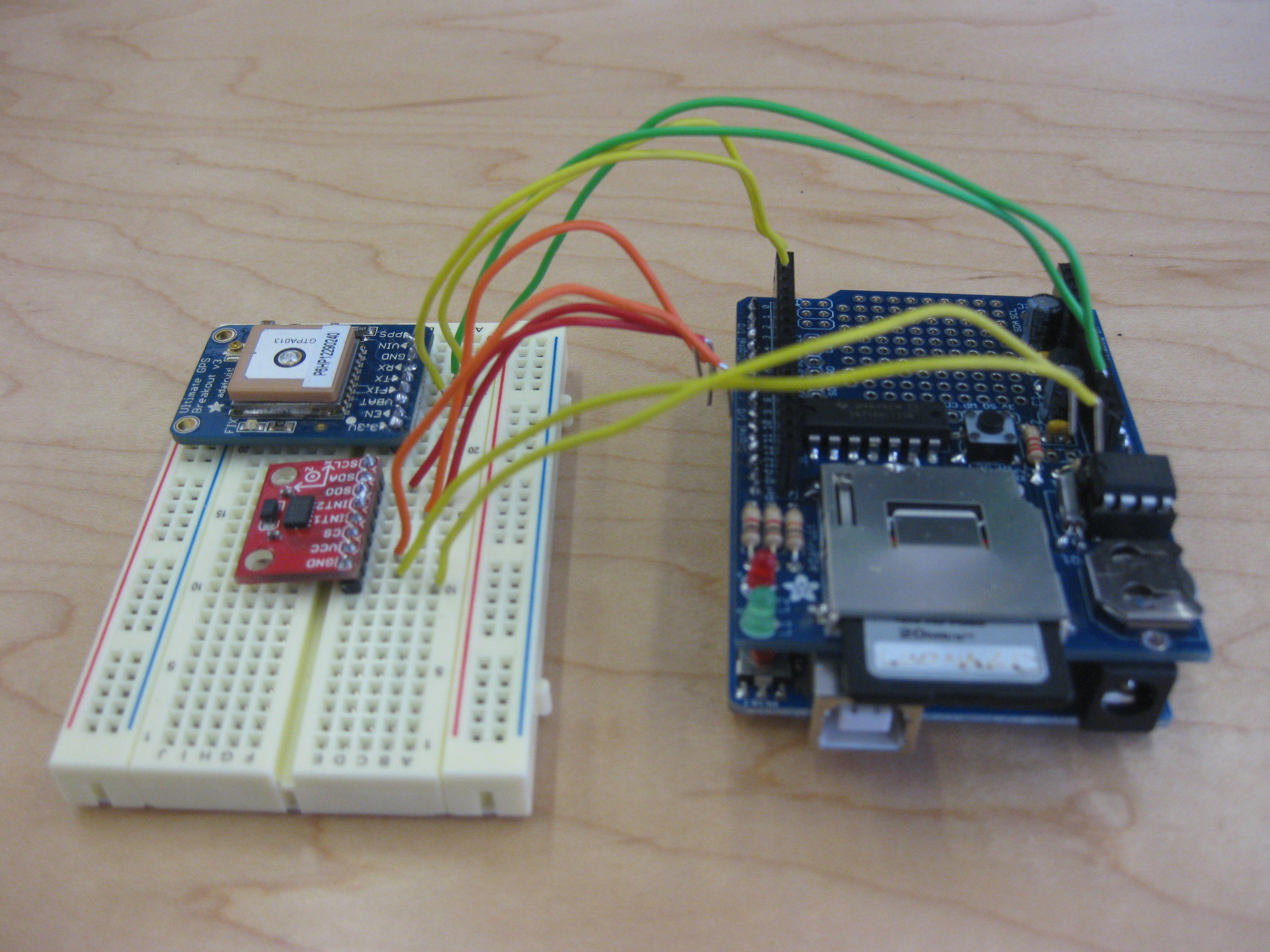
My goal first is to begin remapping the city of Boston’s cycle infrastructure to better map the experience of riding in the city. I am currently building a sensor consisting of a GPS and accelerometer to map the micro-topography in the city, additionally the speed, stops, turns and the side to side motion associated with pedaling hard will be used to redraw how open a street feels to the rider, the faster and smoother the ride, the wider the feeling of the street, the slower and more jerky the ride the narrower the feel.
From this I plan to develop an app that, though not as precise as the sensor I am constructing, has the opportunity to crowd source this data, as well as translate it back to the user, in essence creating real time crowd source mapping.
Where I Stand Now:
I am currently trying to convince all of the components of my sensor to start talking to each other. After about 15 hours yesterday I have come up with a new issue of the card not being read, hopefully that will be remedied shortly. Once that is done I just need to get the accelerometer into the party, we’ll see how that goes.
My hope for this project is that this new mapping will help to inform the urbanization and infrastructural improvements in the city.