Networked Urbanism
design thinking initiatives for a better urban life
apps awareness bahrain bike climate culture Death design digital donations economy education energy extreme Extreme climate funerals georeference GSD Harvard interaction Krystelle mapping market middle east mobility Network networkedurbanism nurra nurraempathy placemaking Public public space resources Responsivedesign social social market Space time time management ucjc visitor void waste water Ziyi

apps
Creating tools for visualization, communication and action in the city. Online, mobile or even desktop applications that allow citizens to get involved in new ways. Designing interfaces that translate data from complex realities into actionable and easy to read/write elements.
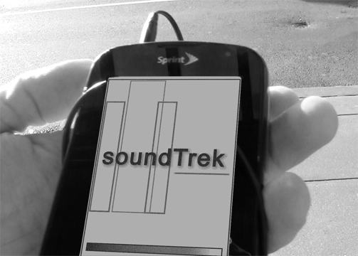
SoundTrek activates space psychically and emotionally by framing and sharing user experience of space in real time and along several experiential axes. SoundTrek is a socio-spatial music sharing mobile application that curates user generated playlists to play back to other users only under specific conditions. Songs are geo-coded and pinned to coordinates along with time, season, weather conditions and user information enabling users to discover, often by surprise, music tied to the spaces they use.
Space + experience = place
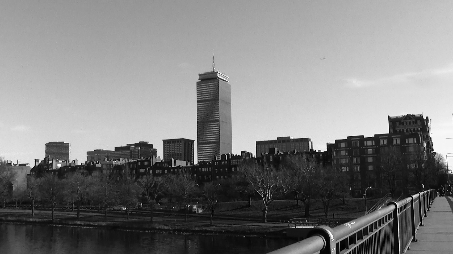
In this equation, the built environment plus the experience of that environment equals “place”. In 2006, the Project for Public Space asked people how they define “placemaking, “ and by far the most frequent and compelling answers included; connection, memorability, shared stories and experience, humanity and the purposeful creation of character and meaning in public spaces. While “place” and “placemaking” often refer to the physical activation of the built environment through design and alteration promoting, usability, the question remains that perhaps there are more subtle techniques that lend themselves to achieving the goals laid out above.
What it takes to “know” a space? What experience of the space leads us to feel connected, to remember, to share, and to feel a space has character and meaning? How did we learn about the spaces we know? What was the lesson and who gave it?
Process
Finding the entry point for this project was no easy task. With the equation above as a template, various ideas were developed from interviews with community activists in Jamaica Plain and East Boston, and videographers in New York City. These included: Pop-up playgroups based on real-time population data delivered from neighborhood playgrounds, the field and playtime allocation for pick-up soccer games in the city, a project on segregation and public space, and a video mapping project based on MyBlockNYC.org.
The project finally landed on Boston’s tour guides, specifically Boston Duck Tours and Cambridge Historical Tours in Harvard Square. Interviews with two of the tour guides who work for these businesses were instrumental in furthering and honing the idea that resulted in SoundTrek. Often tour guides are professional actors who may or may not live in the area. Their job is to entertain. While they pride themselves on their research and local knowledge, they are often directed to recommend certain places and businesses in the city. They share historical and trivial anecdotes about the actual built environment and but their lessons lack the experiential element of the space, thus depriving it of “place.” Adding the element of experience to the lesson of space led to interviews and videos of local people who shared their “favorite places in Boston.” Locals can teach us about both space and their personal experience in the space, but does their experience resonate with us?
 Needle Drop
The ‘needle drop’ is a term used in movies when popular music is laid on a scene in place of traditional score. Nobody knows this better than Quentin Tarantino. Tarantino explains his attention to detail when it comes to music in film in an interview with Arts District. “To me, my soundtracks work as two different things. They work as a little shadow version of the movie itself. If you like the movie and you want to carry it around with you and not have to watch the story all the time but still get the feel and sense of it, they allow you to do that.” Music can be used as shorthand to quickly illustrate a state of mind, an emotion or an experience, it is intimate and connecting. When watching a movie, one knows exactly what to feel at any moment via the scene and soundtrack. SoundTrek would allow users, much like a film director, to frame their real-time, physical scene by “dropping” the perfect audio track to capture the moment and then share that moment with an audience of other users. With one song users could share the idea that “this is me in this space at this moment” thus transforming a space into a place and achieving some of the goals of the Project for Public Spaces; connection, memorability, shared stories and experience, humanity and the purposeful creation of character and meaning in public spaces.
Mapping/Data
The final review of SoundTrek, the idea and rough design, raised interesting questions about data collection and analysis. Presumably one could take the emotional temperature of a city or even a part of the city using the songs and playlists as data points. Over time, cities could be compared to each other and a better data metric for “happiness” could be established. Another interesting piece could be data collected over time in a single city and how the music sharing related to changing demographics and ethnography.
 Final thoughts
SoundTrek is an idea and application that works best in an urban setting because living in the city increases the odds of serendipitous encounters. SoundTrek is the record of a personal moment, though ephemeral, that can lead the user to new discoveries, experiences or feelings. Its expression as a mobile app does not hinder the rhythm and movement of the user through the built environment. SoundTrek is calculated urban serendipity, a romantic, sentimental concept perhaps, but one that provides emotional, intimate, spatial connection in otherwise routine and anonymous urbanity.
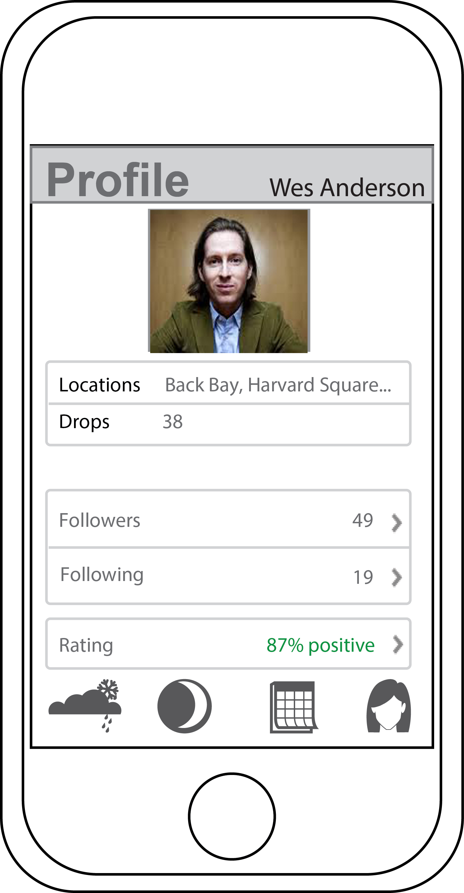
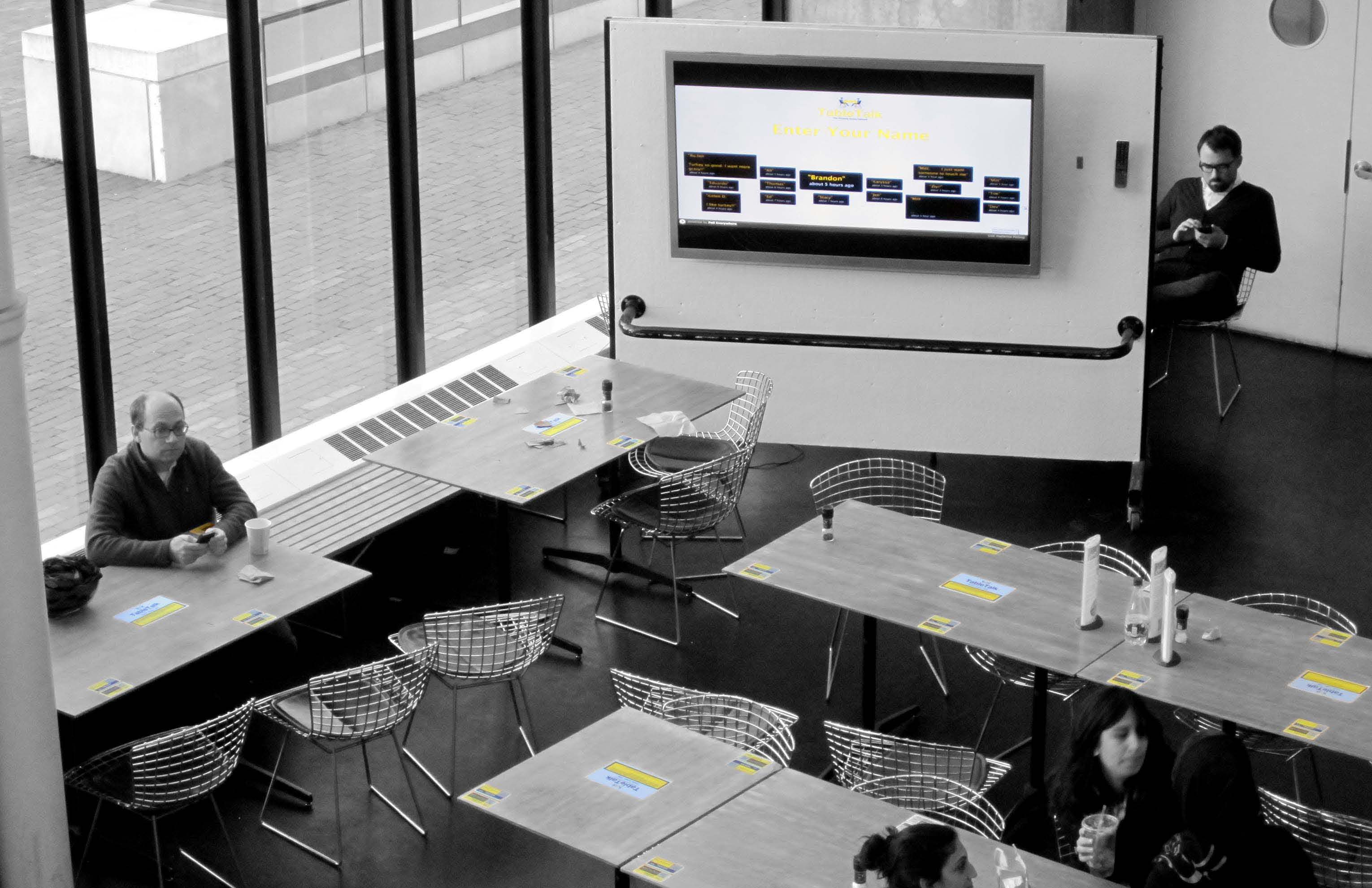
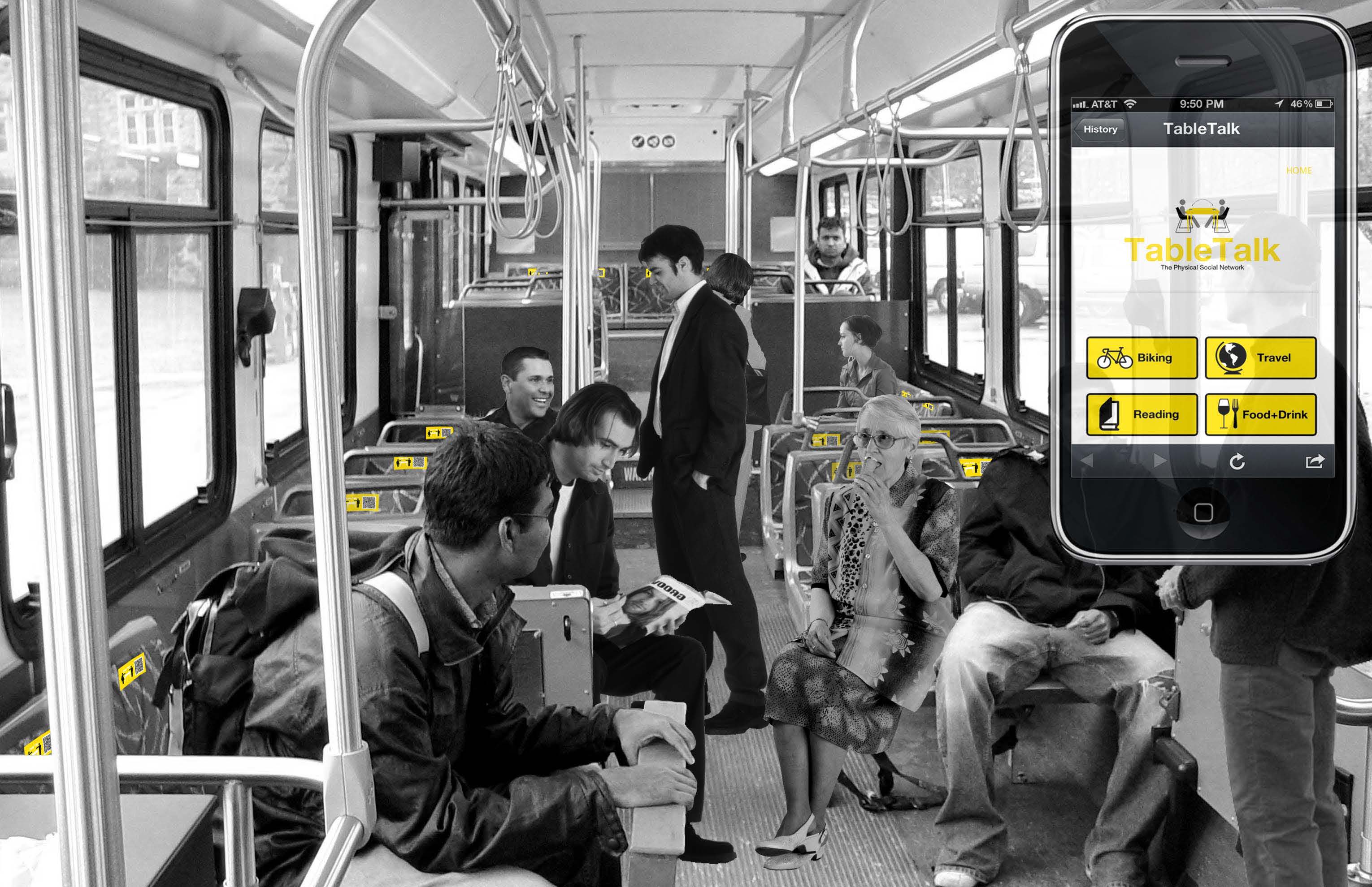
Table Talk is a physical social network connecting individuals of like interests by combining the physical and digital realms of urban space. This new community typology makes formerly invisible layers of shared interest visible in the material space. By embedding personal metadata onto physical objects, a new community work space is developed connecting individuals in both real time and to past occupants; highlighting the importance of the city as place.
Looking at the history of social networking, social connections first and foremost were always spatial. With the invention of the internet, social interaction went from physical to digital and new geo-location technology begins to bring the physical back into social networking, yet only as a dot on a map. What if instead of separating our physical and virtual layers, there was a way our physical environment could become a social network?

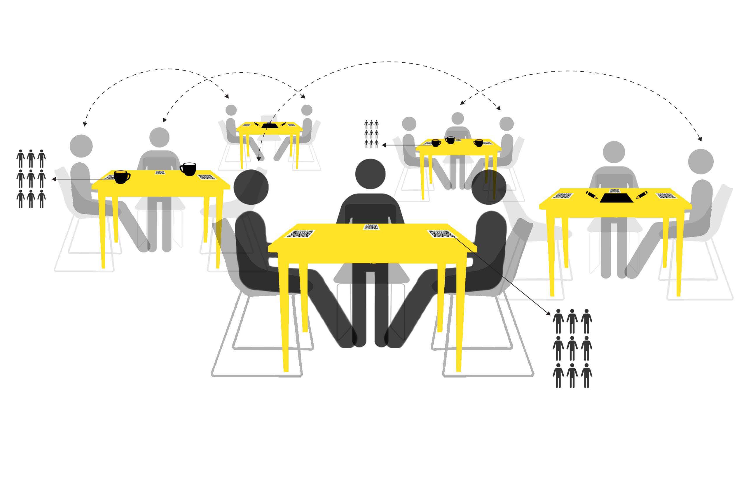
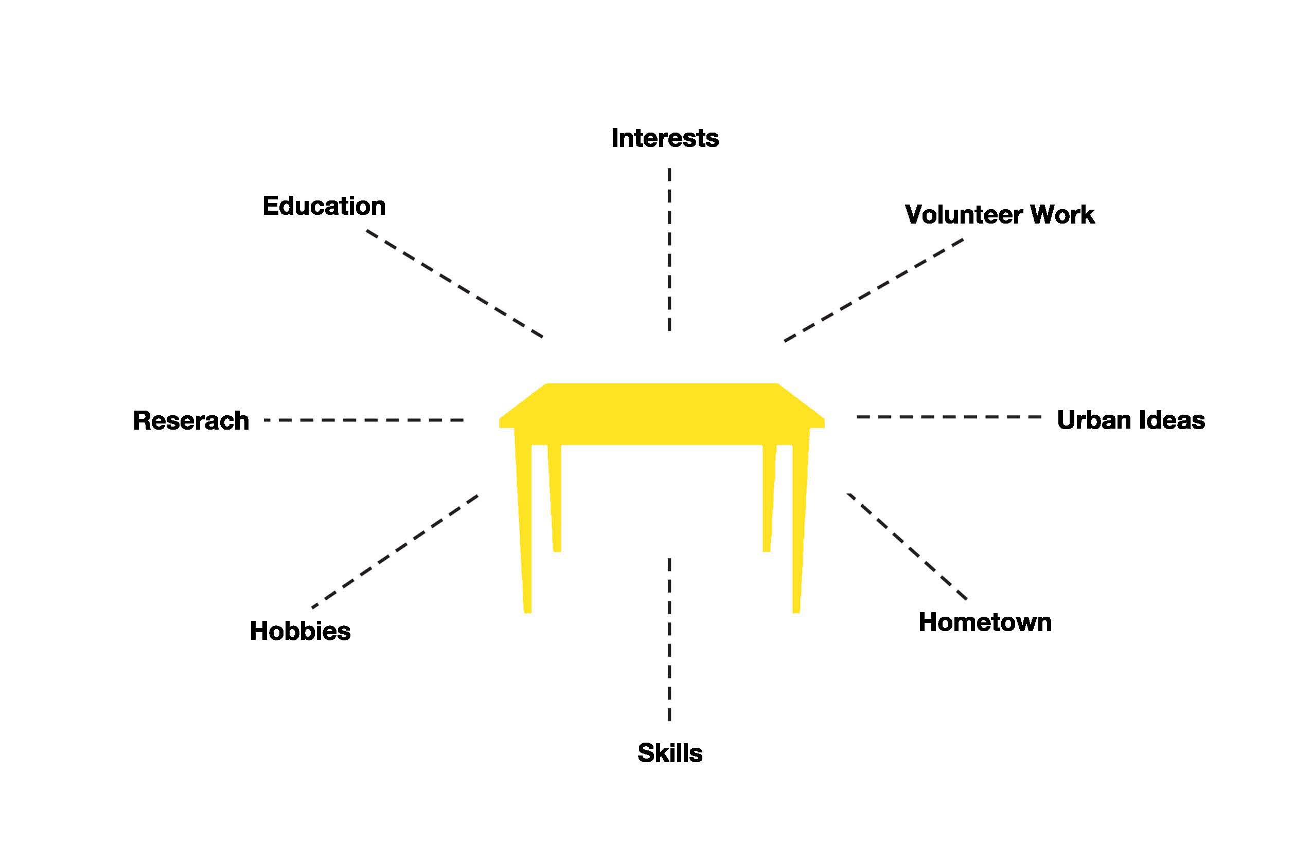
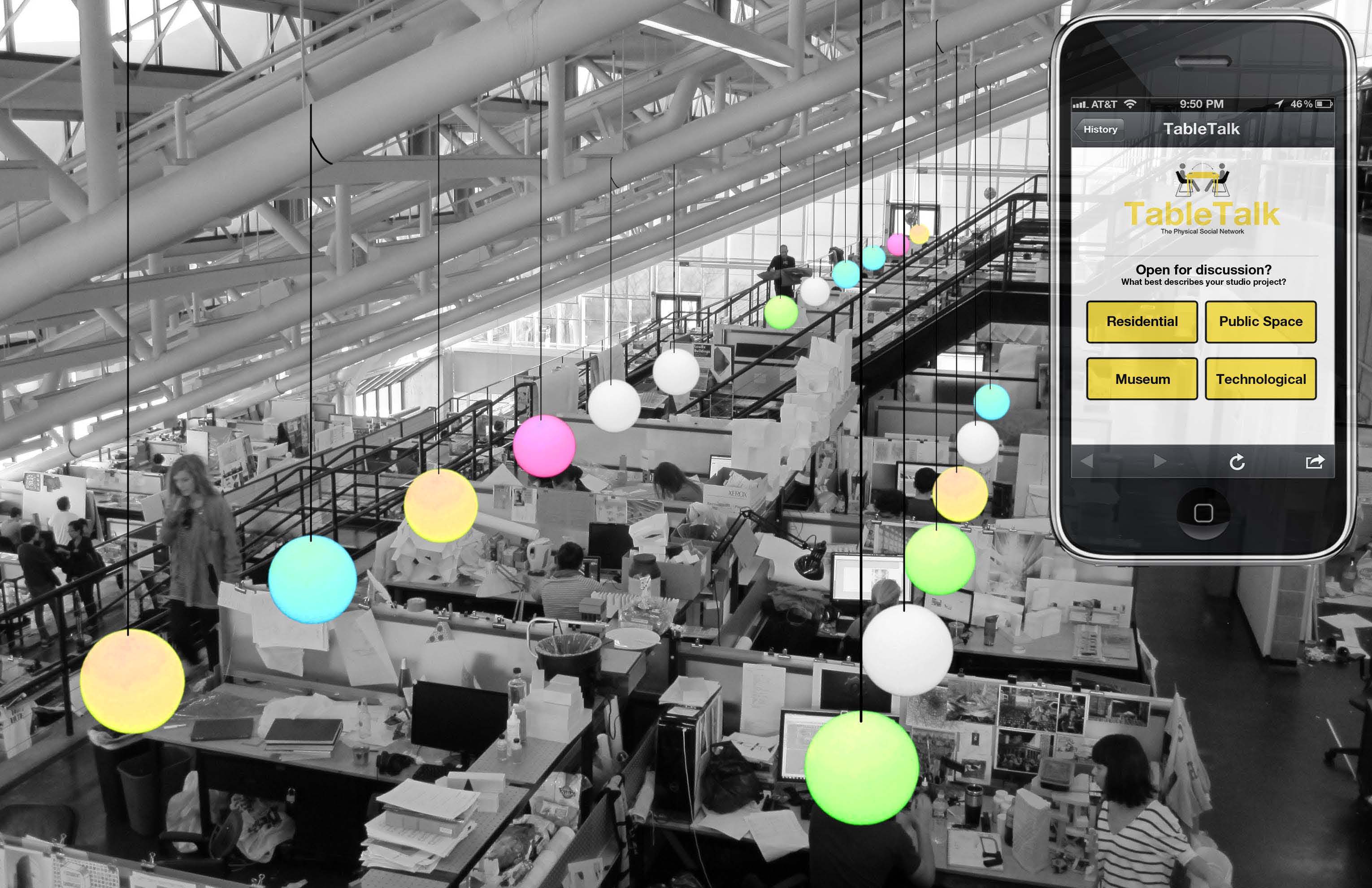
TableTalk is the exploration of the static object with an overlaid layer of digital technology which allows the user to embed personal metadata. Each table is networked into a larger system within the room. As an individual ‘engraves’ their interests onto the table; the system is able to delineate shared layers between occupants, connecting people in real time. Once the table receives an individual’s interests, it retains a trace of that person so that connections can occur across temporalities. Based on chance occurrence of choosing the same table, individuals of shared interests can connect through the physical environment. People can leave traces of themselves on the table for the past and the future; adding a heightened importance to place.
With the increased use of the ‘in between’ place between work and home where individuals come to work independently in public, TableTalk further enhances the social quality of this space. This new typology is a place to work alongside other intellectuals, some of which may share an inherent knowledge base, and connect on mutually beneficial terms. This type of environment not only provides a work space, but starts to break social barriers through place, creating a richer way for people to connect, develop community, provide place for organizing and therefore become a tool for place making.

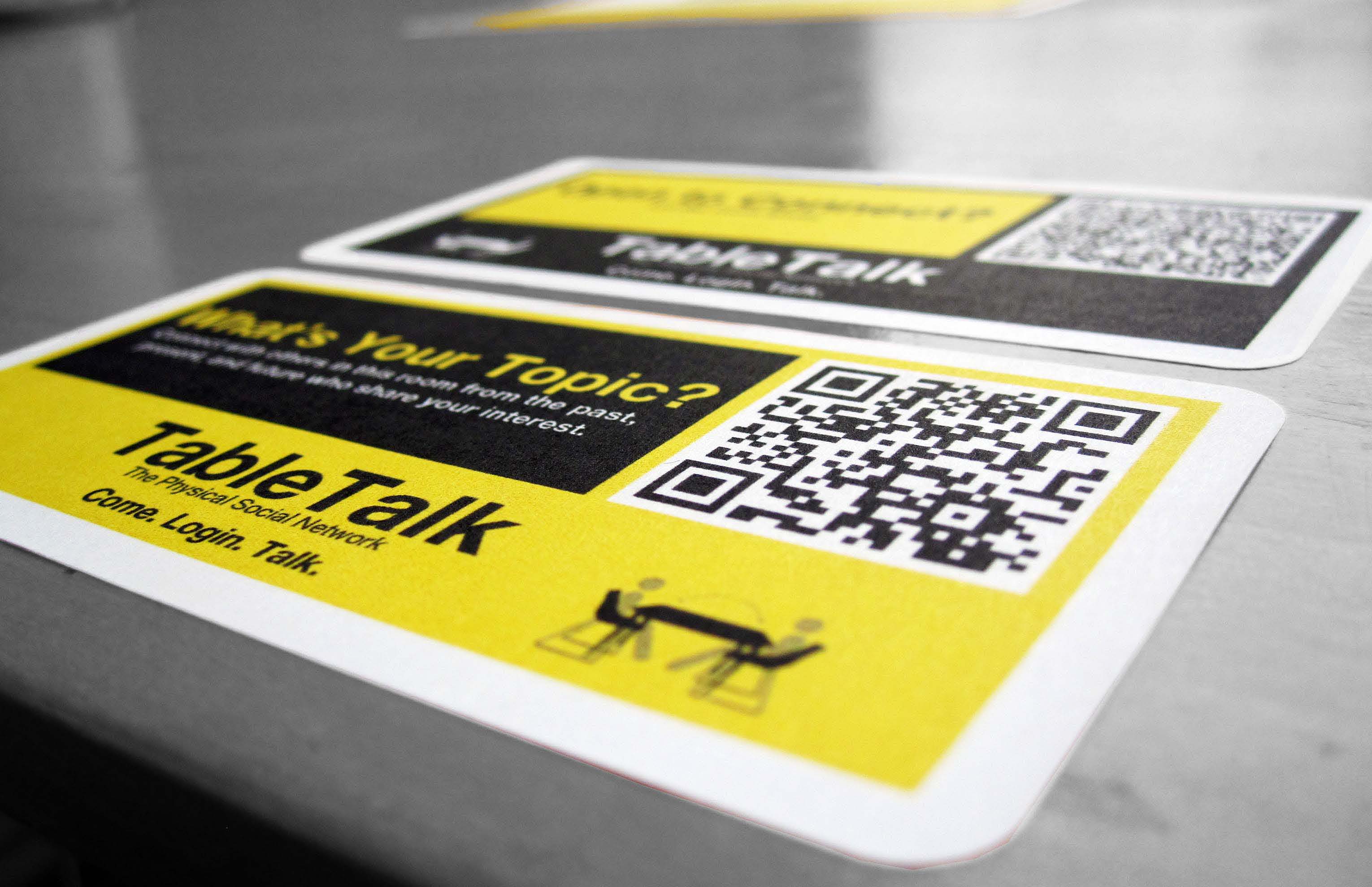
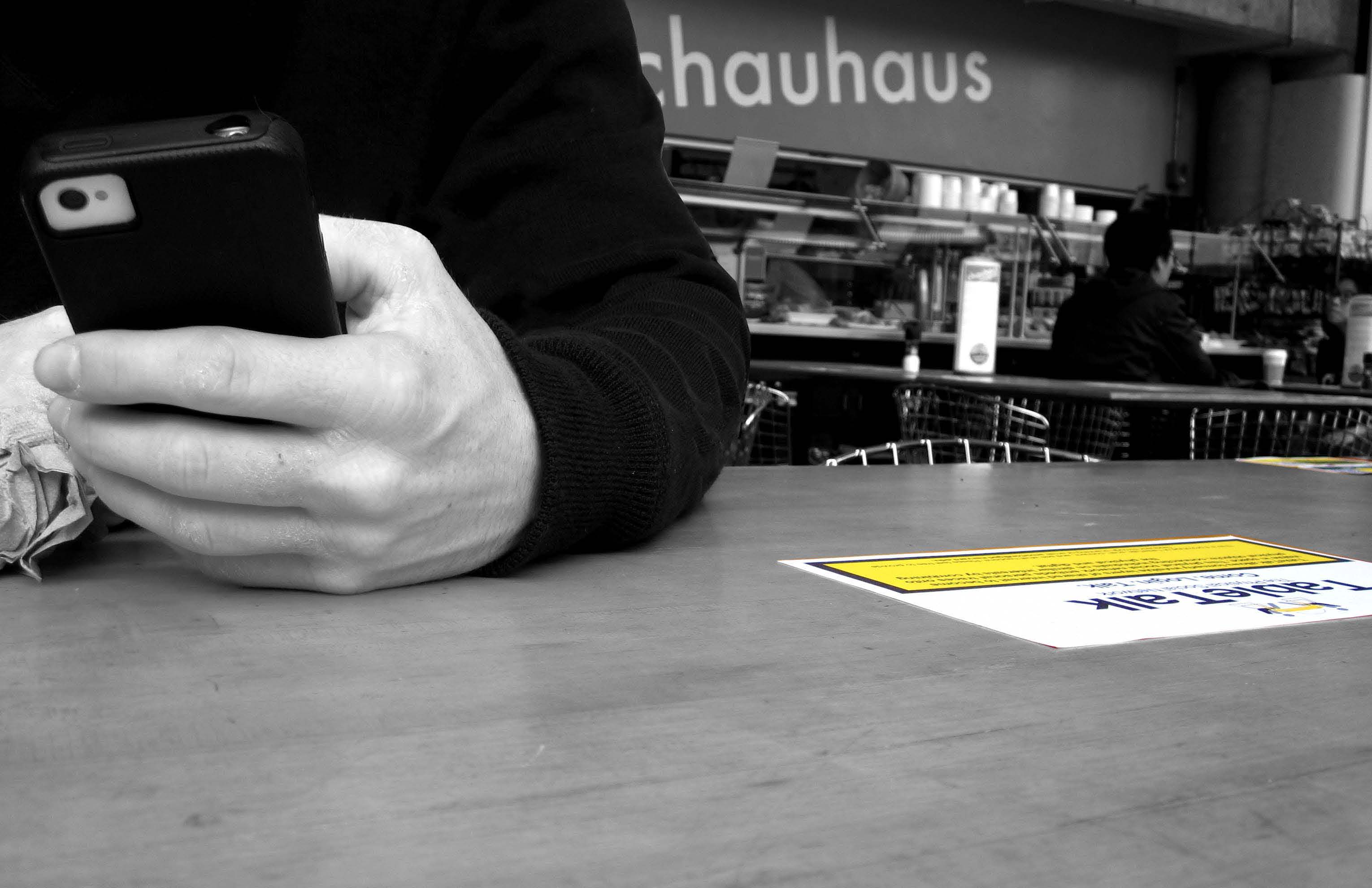
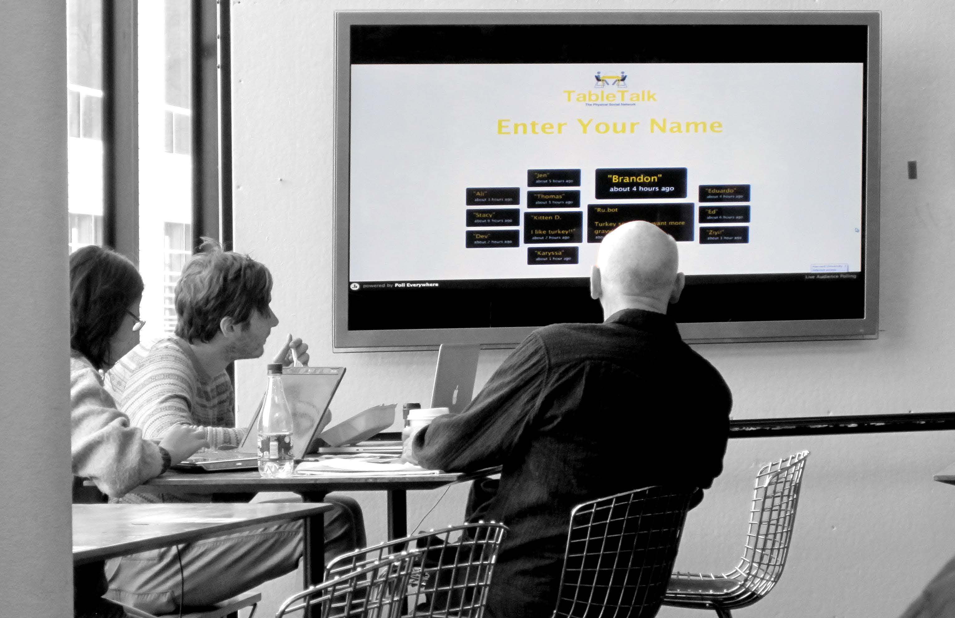
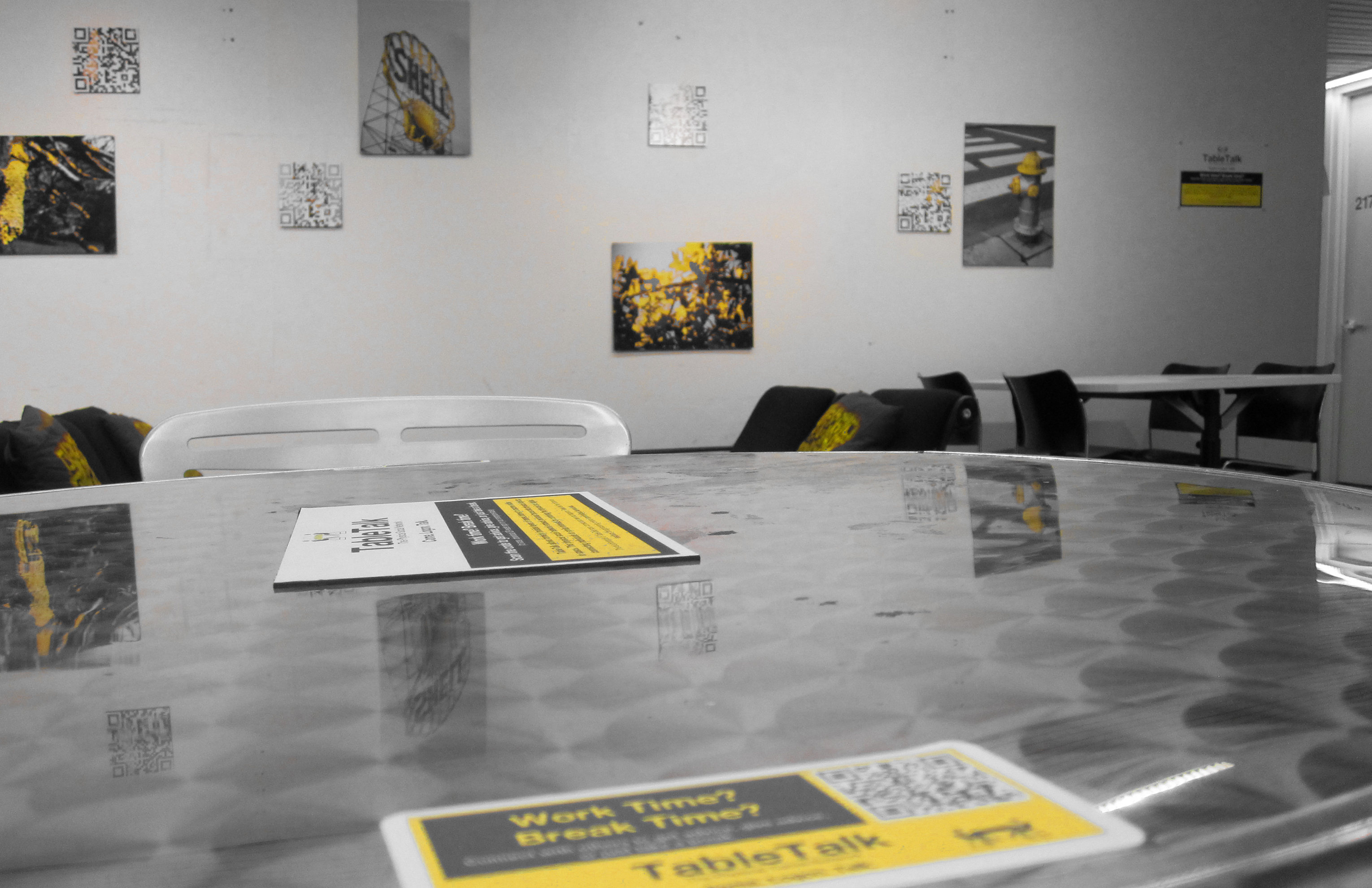
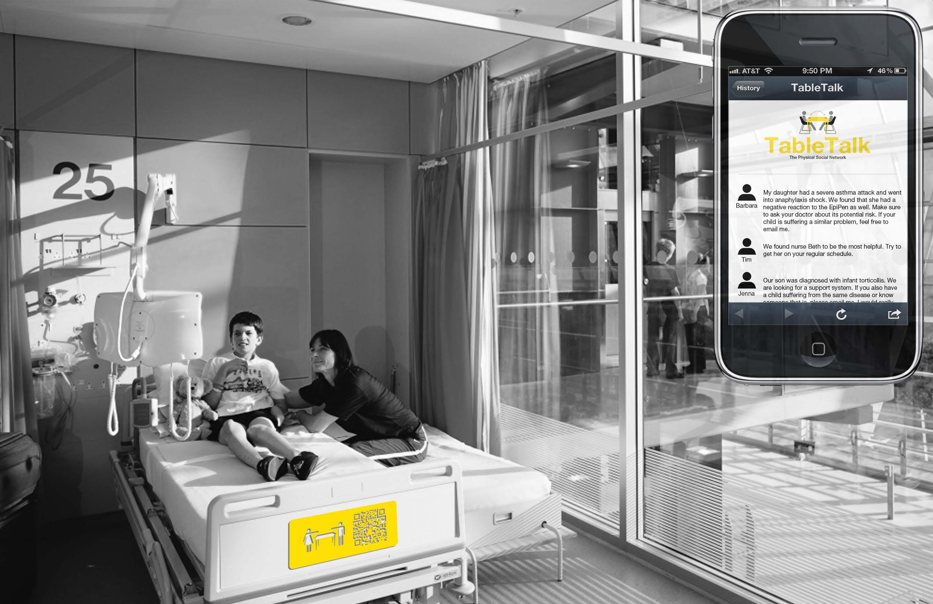
There are several approaches to implementing this physical social network; each incorporating a different level of technology; the first being the simplest means as an overlay onto an existing space. Using QR code stickers, a physical space can be advanced by simply overlaying a digital layer onto its existing surface. The individual can then scan the QR code using their phone and input their layers of interest to begin to connect with others in that space. The first implementation of TableTalk was an overlay in the cafeteria of Harvard’s Graduate School of Design. When a user scanned one of two QR codes on the table, they were prompted to choose one of four topics which brought them to an online message board to reply to past users or leave notes for future. The second QR code let the user leave a visible trace of themselves in the room. When this code was scanned, the user was prompted to enter his or her name which was then immediately displayed on a large plasma screen in the cafeteria. My initial hypothesis was that users would be more willing to use the less visible online message board rather than display their names in public; however I was surprised by the inverse results. More users publicly displayed their name rather than using the online message board. Many went on to further add comments and the screen became a show many would stop to watch. After a few days use, I discovered more messages were added to the online board; most of those in the topic ‘food & drink’; not so surprisingly being in a cafeteria. However, it makes me wonder that if this technology were located in a place without a specific program as this cafeteria had, would TableTalk be able to influence the program of a non-programmed space?


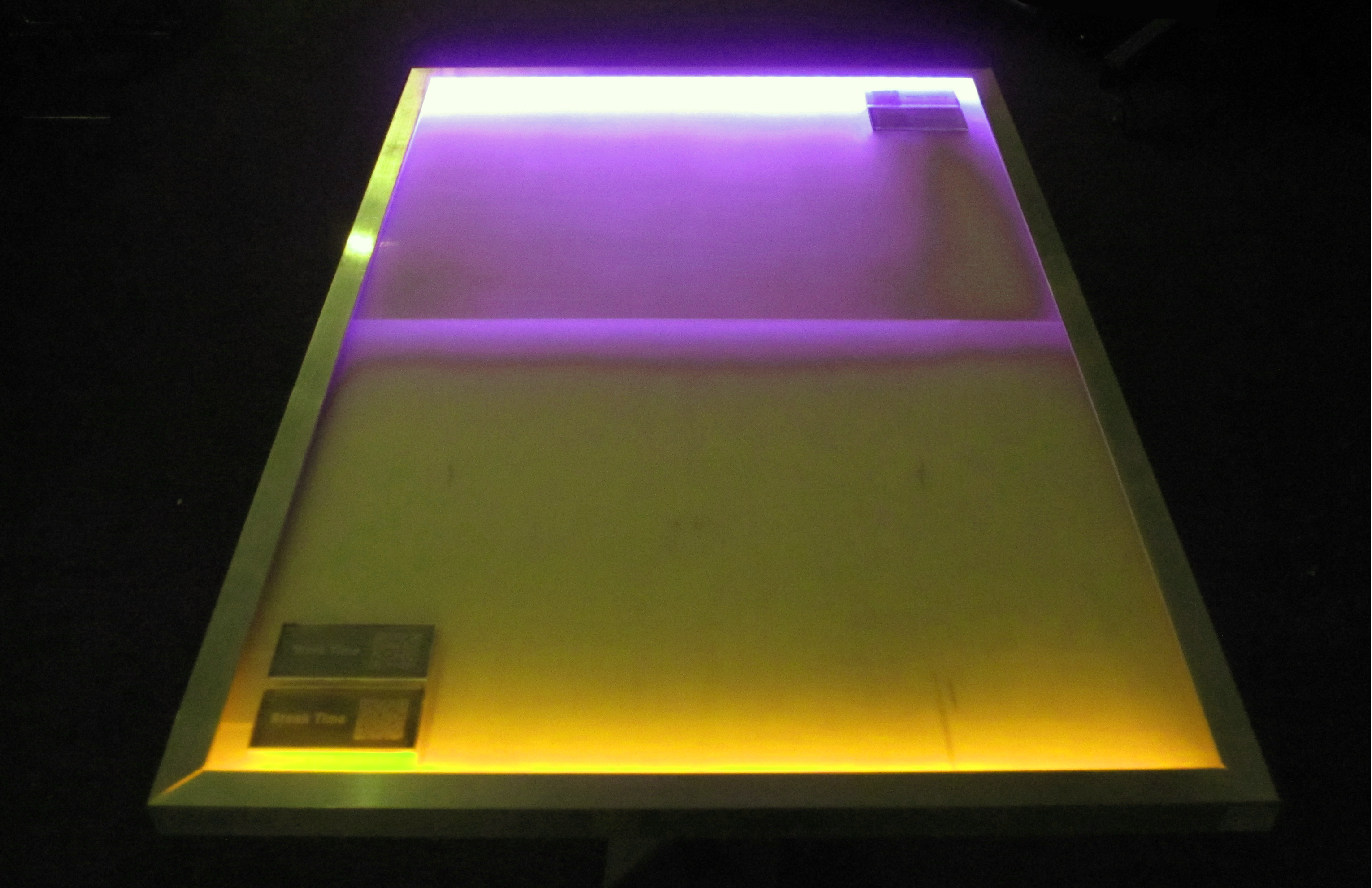
In a fully immersed environment, the technology would be integrated into the table itself; fully combining the digital and physical layers. For this, I designed a responsive table which is capable of absorbing user interest. Depending on the chosen topic, the table adjusts color so that the user is able to quickly look around the room and see others currently in the room with similar interests; breaking that barrier of first conversation starter. The table is also embedded with a QR code which when scanned, connects to all the others who had previously chosen that same seat with the same interest.

By infiltrating unused spaces of our communities with these responsive tables in a layout that promotes social interaction, that ‘in between’ space can begin to act as a place making tool and means for community engagement. This physical social network can begin to connect individuals within the community on deeper and more meaningful levels depending on hobbies, background, research, or need and therefore highlighting the importance of city as place.
Bikenapped is an online platform aimed at raising awareness and mapping bike thefts in Boston. For the public, Bikenapped serves as a place to get a clearer picture of the bike theft problem as well as a community to share your experiences with others. By offering a way for theft victims to reach out to each other, we can learn from our collective experience and band together to help find solutions. The data and narratives that the public provides are valuable as insight to help understand theft patterns and behaviors, as well as the immaterial value of cycling in our city. With better information we can help pursue policy change that can target the problem.
![]()
As Boston works towards becoming a world class bicycling city, promotion of cycling and cycling infrastructure has resulted in significantly rising ridership. However, this increase in cycling correlates with another phenomenon: the dramatic increase in bicycle thefts.
Bike theft is notoriously difficult to investigate, and stolen bicycles are equally difficult to recover. Theft victims often feel violated and helpless in the face of these crimes. There is nowhere for to speak out, no outlet for to take action. By gathering this community of individual voices, we can speak with a collective voice to shed light on the problem, and work together to find solutions.
MAPPING THEFT
One of the issues regarding bike theft lies in the shortage of data on these crimes. According to the reports from the Department of Justice, for every bike theft that is reported to the police, 4 or more thefts may have occurred. This severe underreporting prohibits us from seeing the full scope of the problem and from allocating adequate resources to tackle it. Bikenapped asks the community to participate in a user-generated mapping of theft incidents, to share information with our neighbors and our city.
TAKING ACTION
Raising awareness and disseminating information is crucial in addressing bike thefts. We seek to take the data beyond the digital realm and into the real urban environment we live in. Bikenapped asks users to post notice at the physical place of the theft to warn others of what had happened. The information is not just relevant on the internet, it is more relevant to all the people who use the spaces where these thefts happen.
CONNECTING VOICES
Change happens when we empower everyone to act. While bike theft is something most people experience alone, Bikenapped seeks to connect us with our neighbors and community. If we discover other people had their bikes stolen from the same place as ours, perhaps we can join together to demand for better safety measures in our neighborhood. If law enforcement is aware of certain zones of bike thefts, perhaps they are better equipped to police the area. If we know bikes have been stolen from a particular place, perhaps we will all be more vigilant to keep our neighborhoods safe from bike theft.
PROCESS AND THOUGHTS
The project began through data collection. Through visiting police departments and combing through public log information, we can already begin to see the difficulty in just understanding the bike theft issue in Cambridge. In just the city of Cambridge, there are three separate police departments that holds jurisdiction over different areas: the Cambridge Police Department, the Harvard University Police Department, and the MIT Police Department. In addition the MBTA Transit Police oversees all transit stops. All of these police departments have separate reporting and record keeping methods, which are not collated into a single database, but rather organized internally. From any one source, we can only see a narrow segment of the larger problem. It became clear that in order to understand the issue, we needed a place where information can be collated and made accessible to the public.
Bikenapped became a platform to not merely disseminate information, but also encourage participation. Bike thefts suffer from severe underreporting due to the common perception that nothing will come from a police report. Though the rates of recovery are surely low – and Bikenapped makes no claims at increasing the chances of recovery – a report on Bikenapped is something theft victims and see. It is visible on the map, and visible to every person who comes to visit it. A piece of information or an experience where a victim had once suffered alone, is now directly and visibly a contribution to a larger story and effort.
The reaction to Bikenapped has been extremely positive. As different media outlets and cycling blogs began to pick up the story, reports and emails started coming in. We had over 2500 unique visitors within the first 12 days, many from beyond the borders of Boston/Cambridge, all the way from Portland and California. The issue surely struck a cord to people, and the support and response that Bikenapped received validated the need for its existence.
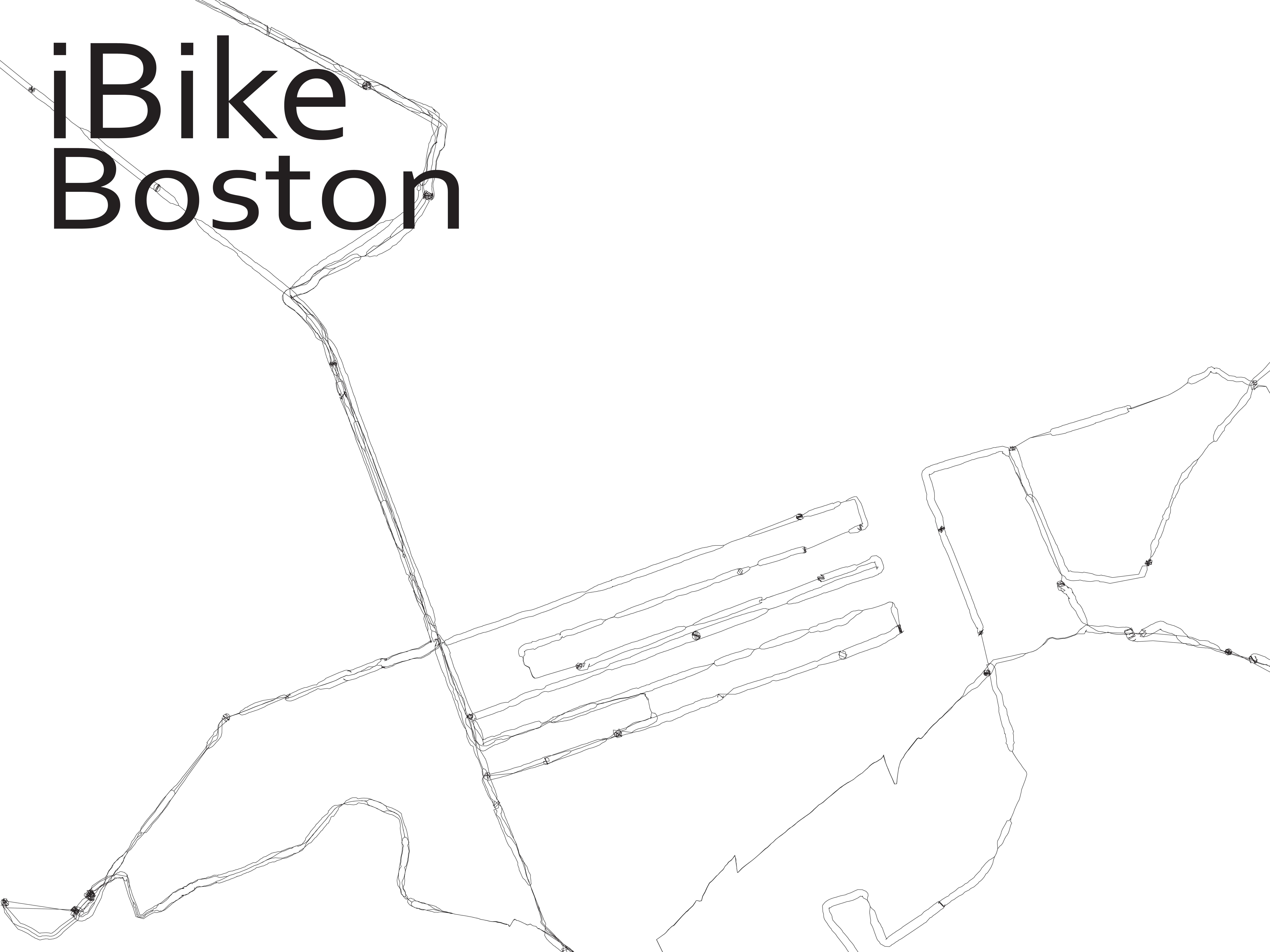
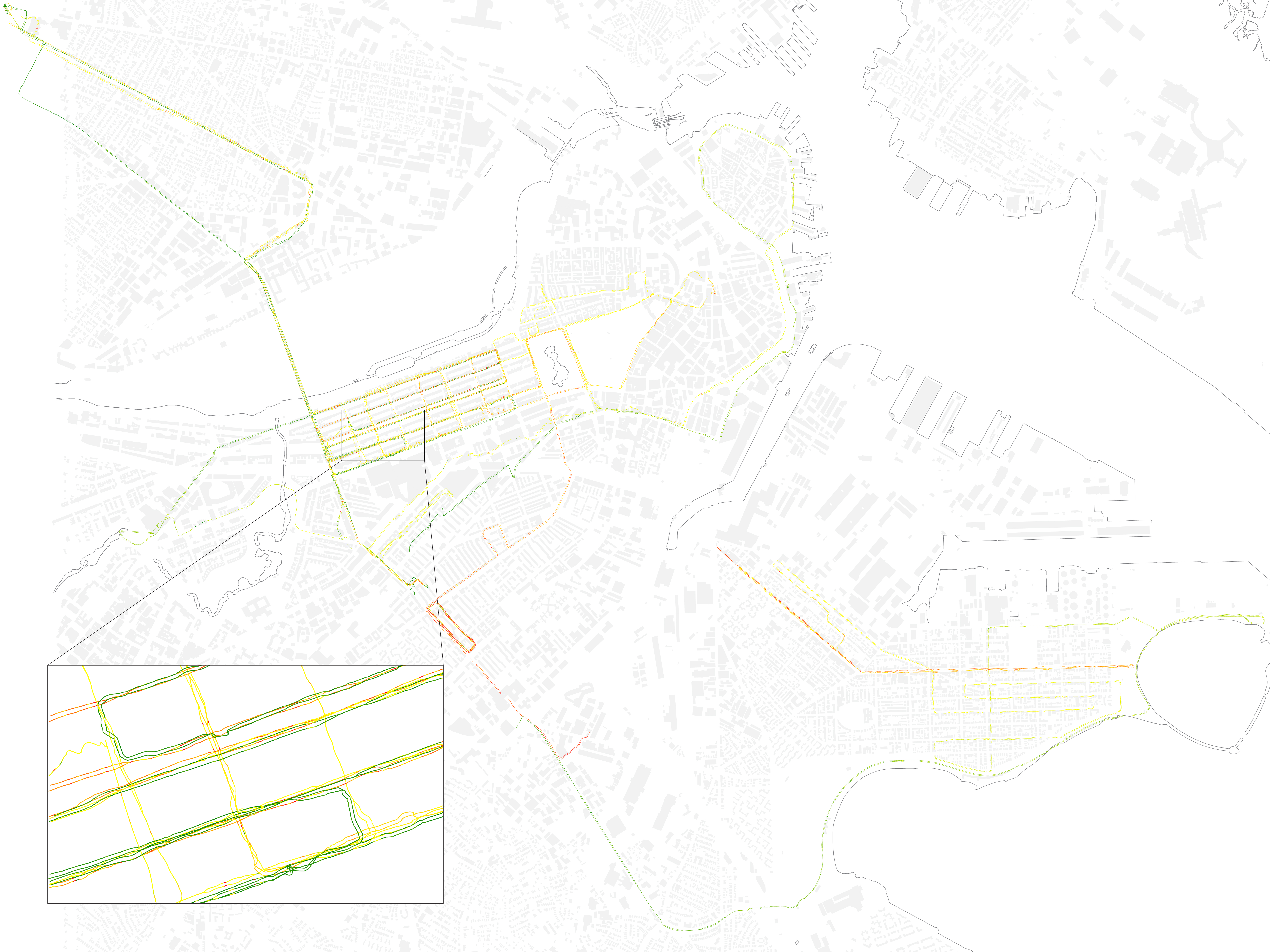
iBike Boston is a project on re-mapping the city of Boston in an effort to draw the experience of cycling in the city. By mounting a sensor that links accelerometer and GPS data to the handlebars of my bike and riding the city I have been mapping the micro-topography of the streets and the speed of travel, this information is used to redraw the streets to better show the experience of riding in Boston.

SoundTrek is a socio-spatial music sharing mobile app that takes you on an augmented sensory journey through urban space. SoundTrek runs in the background on your phone, IPod or other GPS enabled device. When in “drop mode”, much like a film director, users can frame their real-time, physical scene by “dropping” the perfect audio track to capture the moment. When users in “listen mode” get close to a geocoded marker, SoundTrek turns down their music and turns up an audio file that has been “left” there for them to find, delivering user-generated content that is temporal, seasonal, environmental and site specific. SoundTrek is a new way for people to share their city and their urban experiences in a way that is subtle, intimate, and personal. It is effective, effortless place-making that provides the opportunity for those who use the space to share their experience of the space with other users.
![]()
Hear Here! is a platform that allows you to engage in virtual discussions with people within your vicinity. You can target an audience based on their location (be it your neighbors, concert goers, park patrons, building occupants, etc.) and engage in a rich exchange of information (ie. discussions, photo sharing, classifieds, comments, announcements, etc.). Hear Here aims to strengthen community by facilitating communication amongst other locals.

TableTalk is a physical social network connecting individuals of like interests by combining the physical and digital realms of urban space. This new community typology makes formerly invisible layers of shared interest visible in material space. By embedding personal metadata onto physical objects, a new community work space is developed connecting individuals in both real time and to past occupants; highlighting the importance of the city as place.
I am currently exploring the many ways this system can be implemented; including overlay onto existing program, embedding into objects, enhancing the social environment, and designing a new typology all together.

Bikenapped aims to raise awareness for bike thefts and empower cyclists to take action.
As Boston works towards becoming a world class bicycling city, promotion of cycling and cycling infrastructure has resulted in significantly rising ridership. However, this increase in cycling correlates with another phenomenon: the dramatic increase in bicycle thefts.
Bike theft is notoriously difficult to investigate, and stolen bicycles are equally difficult to recover. Theft victims often feel violated and helpless in the face of these crimes. There is nowhere for to speak out, no outlet for to take action. By gathering this community of individual voices, we can speak with a collective voice to shed light on the problem, and work together to find solutions.
MAPPING THEFT
One of the issues regarding bike theft lies in the shortage of data on these crimes. According to the reports from the Department of Justice, for every bike theft that is reported to the police, 4 or more thefts may have occurred. This severe underreporting prohibits us from seeing the full scope of the problem and from allocating adequate resources to tackle it. Bikenapped asks the community to participate in a user-generated mapping of theft incidents, to share information with our neighbors and our city.
TAKING ACTION
Raising awareness and disseminating information is crucial in addressing bike thefts. We seek to take the data beyond the digital realm and into the real urban environment we live in. Bikenapped asks users to post notice at the physical place of the theft to warn others of what had happened. The information is not just relevant on the internet, it is more relevant to all the people who use the spaces where these thefts happen.
CONNECTING VOICES
Change happens when we empower everyone to act. While bike theft is something most people experience alone, Bikenapped seeks to connect us with our neighbors and community. If we discover other people had their bikes stolen from the same place as ours, perhaps we can join together to demand for better safety measures in our neighborhood. If law enforcement is aware of certain zones of bike thefts, perhaps they are better equipped to police the area. If we know bikes have been stolen from a particular place, perhaps we will all be more vigilant to keep our neighborhoods safe from bike theft.
THINK BIG
How can I promote knowledge of space that is specific to actually being in the space? For the most part, we’re introduced to different spaces by someone who already has that knowledge. Originally I was trying to find a way to enable access and knowledge of space via social networking, apps, etc. through locally generated user content. However as the project has progressed, I’ve zeroed in the idea of “Boston” and its “spaces” as taught/shown by professional tour guides. Where do they get their information? Are their tours edited in any way by the corporate tour operators? Are they even from Boston? What do they think is missing from the tour? What if they had to give a tour to an audience of locals? Is authenticity of the experience/showing/teaching of Boston irrelevant?
Where is this going? I’m preoccupied with 2 questions: 1. Are visitors to Boston who do NOT desire the “knowledge of urban spaces” achieved by actually being there learning anything that is authentic or ideosyncratic about Boston specifically? Can you learn a city from the back of a duck boat? 2. The mirror to this would be; are visitors to Boston who use services like airbnb or yelp perhaps to have a more “authentic” experience of a city missing out as well? Regular local friends or tour guides aren’t going to take visitors to the “usual” spaces, but aren’t these spaces part of an “authentic” Boston experience too? Can you learn a city by ignoring its major, popular attractions?
START SMALL
There are at least 6 major tour operators in the city of Boston with maps and advertisements in major Back Bay hotels; the Marriot, the Westin and the Sheraton. On Sunday I visited the hotels and picked up every map and tour brochure available. (I was actually in the lobby of the Marriot when the Dalai llama arrived – thrilling!) The tours fall into mainly 3 categories; walking, on-off trolley loops where you’re encouraged to hop on and off the trolley and explore on your own, and motorized land-sea vehicle tours. There are other, more specialized tours where bikes or even Segways are used to get around.
I chatted with Deb, the desk representative for Old Towne Trolley tours and told her I was a local. Old Towne Trolley tours is actually a chain that operates in several cities. I asked Deb if she knew how Old Towne had plotted the route for their tour but she didn’t know. Interestingly an email I received back from Boston Duck Tours President and CEO Cindy Brown made the same claim. But I’ve been in contact with the founder of Cambridge Historical tours Daniel Berger-Jones and am trying to arrange and interview to specifically address this question. I’m also hoping he can connect me with more actual tour guides to interview.
I also visited the Boston Convention & Visitors Bureau unannounced & with no appointment but couldn’t get past the front desk. I did collect the names of a few people there who might be helpful with background information about how Boston is “marketed” to visitors.
As it was raining and I’m broke, I did not take a Duck Tour (30$ bucks!) nor did I visit Cheers. Yet.
I’ve established a few good connections and am following up with interviews this week.
GSD-Academic – Judith Grant Long Associate Professor of Urban Planning who studies the planning and effects of tourism on cities. Robert Pietrusko who will hopefully help me represent all this digitally/visually.
Corporate Tour Operators – Cindy Brown, President & CEO of Boston Duck Tours, Debi Jo Michael, Rick Steves’ Europe – Tour Operations & Planning,
Daniel Berger-Jones, Founder Cambridge Historical Tours
Background/Big Picture – Mike Healy, GSD Student and former tourism professional/tour guide, Pam Frechette, Visitor Marketing Manager Boston Convention & Visitors Bureau
I’ve also been down to Duck Tours twice and had some informal chats with tour guides and tour workers.
Next steps will be gathering expert info from my connections, mapping the tour routes and researching alternative stops, sights, spaces and developing my tour guide interview questions.
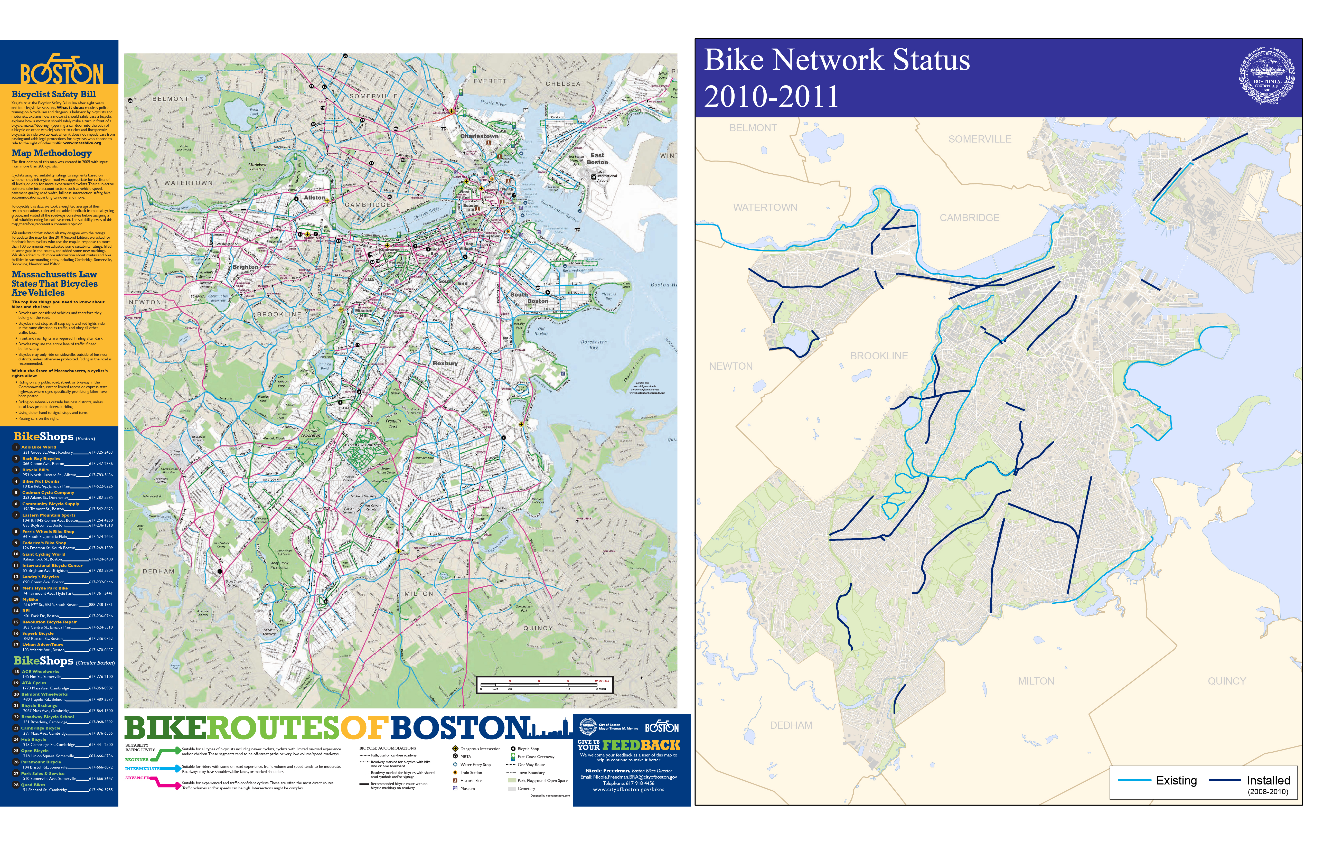
Riding a bike around the city of Boston you come to realize quite quickly that the cycle infrastructure is lacking. Even with the declaration by Mayor Menino that in Boston “the car is no longer king” and the cities recent focus on improving the cities cyclability, riding in the city is tough, scary and at times down right dangerous. The infrastructural improvements consist mostly of painted line bike lanes and Sharrows (painted bicycle arrows indicating an acceptable space within the lane a cyclist can occupy). While researching the current conditions I found that the mapping of the cycle infrastructure, and more the experience to be completely lacking. The maps of cycle lanes mainly consist of diagramatic overlays on plain google maps. I realized that there is not a map (at least I have not found one) that has the actual lanes drawn in. This type of mapping is deceiving to the rider as the system that exists is disjunct and rough with potholes and seamed pavement.
My goal first is to begin remapping the city of Boston’s cycle infrastructure to better map the experience of riding in the city. I am currently building a sensor consisting of a GPS and accelerometer to map the micro-topography in the city, additionally the speed, stops, turns and the side to side motion associated with pedaling hard will be used to redraw how open a street feels to the rider, the faster and smoother the ride, the wider the feeling of the street, the slower and more jerky the ride the narrower the feel.
From this I plan to develop an app that, though not as precise as the sensor I am constructing, has the opportunity to crowd source this data, as well as translate it back to the user, in essence creating real time crowd source mapping.
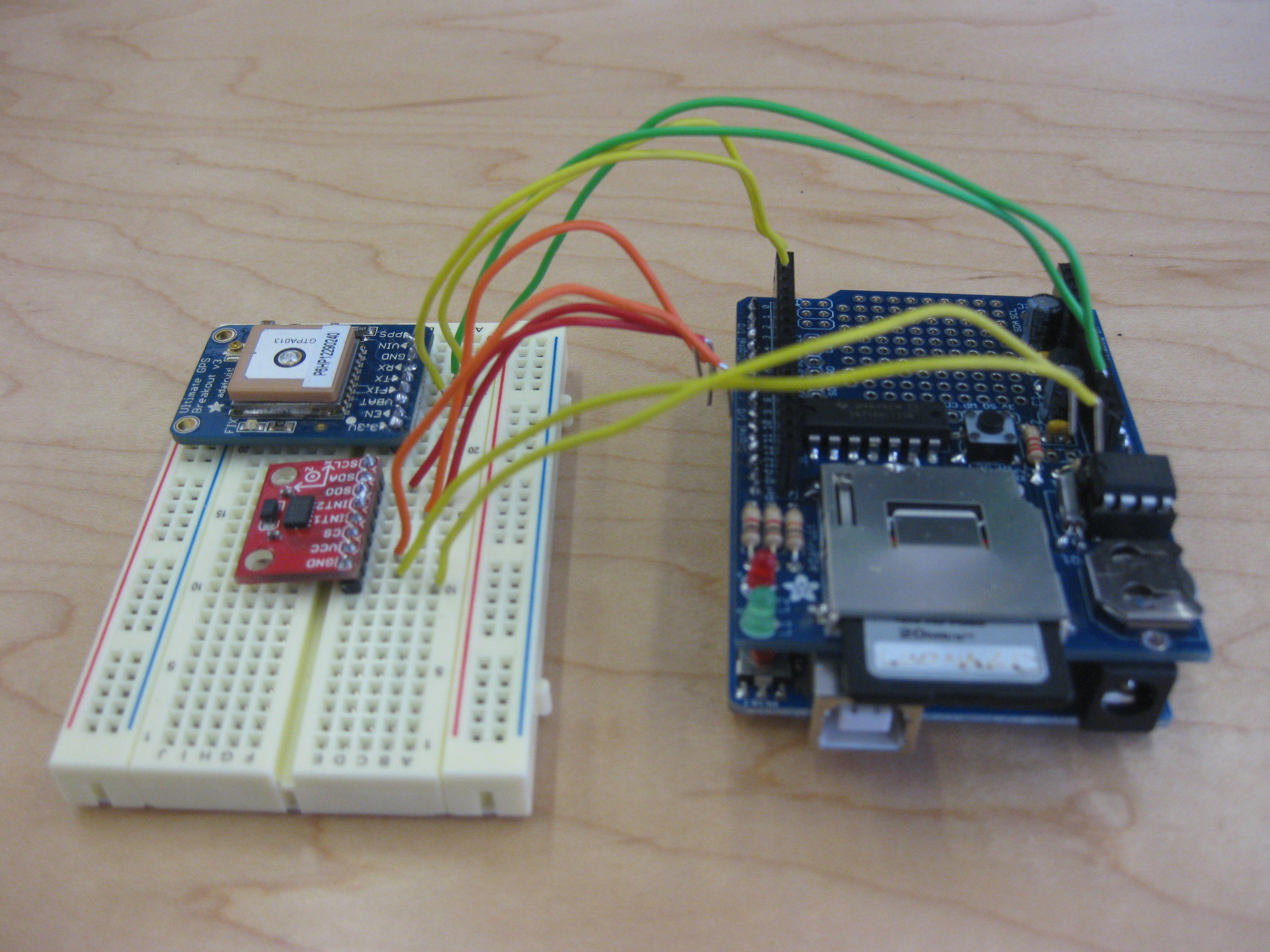
Where I Stand Now:
I am currently trying to convince all of the components of my sensor to start talking to each other. After about 15 hours yesterday I have come up with a new issue of the card not being read, hopefully that will be remedied shortly. Once that is done I just need to get the accelerometer into the party, we’ll see how that goes.
My hope for this project is that this new mapping will help to inform the urbanization and infrastructural improvements in the city.
« Previous 1 2 3 4 5 6 Next »